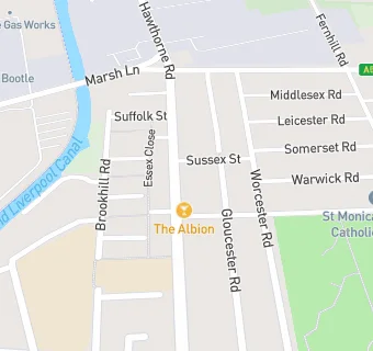
BLOCLEats

Albion Hotel

408 Hawthorne Road
Bootle
Merseyside
L209AY

Food rating: ★★★★ 4/5 stars
Updated: 30. November 2017

map for Albion Hotel

Near Albion Hotel

  1. Bars & Nightclubs
  2. 0.2 miles★★★★★St Monicas Parish Centre, L209JD
  3. 0.3 miles★★★★★Addison Arms - K-Town/Fluster Cluck/Locked & Loaded/88th Street/Value, L203LT
  4. 0.3 miles★★★★The Beaconsfield, L203HL
  5. 0.3 miles★★The Wild Rose, L203EF
  6. 0.4 miles★★★★★Orrell & District Veterans Club, L200AH
  7. 0.5 milesCat & Fiddle, L203LG
  8. 0.7 miles★★★★★The Breeze, L91BQ
  9. 0.7 miles★★★★★St Elizabeths Parochial Centre, L218HZ
  10. Retail Stores
  11. 0.2 milesNaturavivauk Ltd, L209DE
  12. School Food Ratings
  13. 0.1 miles★★★★★Christ Church Primary School, L203JL
  14. Chemists
  15. 0.2 milesDrakes Pharmacy, L209DL
  16. 0.2 milesSmartts Chemist, L209HH
  17. 0.3 milesPark Street Pharmacy, L203DF
  18. Doctors
  19. 0.2 milesAintree Road Medical Centre, L209DL
  20. 0.3 milesConcept House Surgery, L203BG
  21. 0.3 milesPark Street Surgery, L203DF
  22. Schools Nursery
  23. 0.5 milesCambridge Nursery School, L209LQ (85 pupils)
  24. 0.5 milesGreenacre Community Nursery School, L206PJ (69 pupils)
  25. Schools Primary
  26. 0.1 milesChrist Church Church of England Controlled Primary School, L203JL (450 pupils)
  27. 0.3 milesSt Monica's Catholic Primary School, L209EB (455 pupils)
  28. 0.5 milesLinacre Primary School, L205ED (139 pupils)

See all Bars & Nightclubs in Liverpool.