BLOCLEats

Aldi

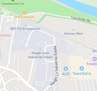
5 Haugh Lane Industrial Estate
Hexham
Northumberland
NE463PU

Food rating: ★★★★★ 5/5 stars
Updated: 19. April 2022

map for Aldi

Near Aldi

  1. Supermarkets
  2. 0.2 miles★★★★★Lidl, NE463BS
  3. 0.2 miles★★★★★Tesco, NE463PJ
  4. 0.3 miles★★★★★Waitrose, NE463PD
  5. 0.4 miles★★★★★The Range, NE461PU
  6. 0.5 miles★★★★★Co-op Food, NE463BH
  7. 3.3 miles★★★★★The Co-operative, NE455AA
  8. 5.8 miles★★★★★North Eastern Co-operative Society, NE476ET
  9. 8.1 miles★★★★★Allendale Co-operative Society Ltd, NE479BD
  10. Care Facilities
  11. ★★★★★Apple Blossom, NE463PU
  12. ★★★★★Tynedale Centre, NE463LF
  13. Food Trucks
  14. 0.1 miles★★★★★Fire & Dough, NE463HN
  15. Bars & Nightclubs
  16. 0.2 miles★★★★★Hexham Ex Servicemens Club, NE463PQ
  17. Restaurants & Cafés
  18. ★★★★★Top Nosh, NE463PU
  19. 0.1 miles★★★★★Adapt Cafe, NE463HY
  20. Retail Stores
  21. 0.1 miles★★★★★Hexham Service Station, NE463QQ
  22. Chemists
  23. 0.2 milesTesco Instore Pharmacy, NE463PJ
  24. Schools
  25. 0.7 milesHexham Priory School, NE461UY (117 pupils)
  26. Schools Middle Deemed Secondary
  27. 0.5 milesHexham Middle School, NE463JB (599 pupils)
  28. Schools Primary
  29. 0.2 milesThe Sele First School, NE463QZ (392 pupils)
  30. 0.4 milesSt Mary's Catholic First School, Hexham, NE462EE (98 pupils)
  31. Schools Secondary
  32. 0.7 milesQueen Elizabeth High School, NE463JB (1287 pupils)

See all Supermarkets in Hexham.