BLOCLEats

Allsorts

Marsden Mall
Pendle Rise Shopping Centre
Manchester Road
Nelson
BB98ET

Food rating: ★★★★★ 5/5 stars
Updated: 8. April 2024

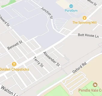
map for Allsorts

Near Allsorts

  1. Retail Stores
  2. ★★★★★S & S Greengrocers, BB98ET
  3. 0.1 miles ★★★★★W H Oddie Ltd, BB98RW
  4. 0.1 miles ★★★★All Vapes And Sizes Ltd, BB98RW
  5. 0.1 miles ★★★★★Spar Store, BB98RP
  6. 0.1 miles ★★★★★Farmfoods, BB98ER
  7. 0.1 miles ★★★★★Asda Express Colne PFS, BB88LF
  8. 0.3 miles ★★★Local Saving Store, BB98AP
  9. 0.3 miles ★★★★★B & M Stores, BB88LU
  10. Care Facilities
  11. 0.2 miles ★★★★★Dercliffe Care Home Ltd, BB98RH
  12. Bars & Nightclubs
  13. 0.1 miles ★★★★★Spinning Mill, BB88LF
  14. Restaurants & Cafés
  15. 0.1 miles ★★★★★Age UK Lancashire, BB98RW
  16. 0.2 miles ★★★★Glenfield Cafe, BB98AP
  17. School Food Ratings
  18. 0.2 miles ★★★★★Pendle Vale College, BB98LF
  19. Takeaway Shops
  20. 0.1 miles ★★★★★Saminos, BB98RP
  21. 0.1 miles The Filling Station, BB98RP
  22. 0.1 miles ★★★★★Golden Chopsticks, BB98RW
  23. Schools
  24. 0.2 miles Pendle Community High School & College, BB98LF (162 pupils)
  25. 0.3 miles Pendle View Primary School, BB88JT (131 pupils)
  26. Schools Primary
  27. 0.4 miles Castercliff Primary School, BB98JJ (402 pupils)
  28. Schools Secondary
  29. 0.1 miles Pendle Vale College, BB98LF (1055 pupils)
  30. 0.4 miles Ss John Fisher and Thomas More Roman Catholic High School, BB88JT (806 pupils)