BLOCLEats

Bede's Helping Hands Food Bank

Primrose Library
Glasgow Road
Jarrow
Tyne & Wear
NE324AU

Food rating: ★★★★★ 5/5 stars
Updated: 23. June 2022

Food ratings

Confidence in management: 5
Hygiene: 5
Structural: 5
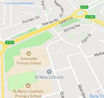
map for Bede's Helping Hands Food Bank

Near Bede's Helping …

  1. Catering Services
  2. 0.2 miles★★★★PERTH GREEN COMMUNITY ASSOCIATION, NE324AQ
  3. 0.2 miles★★★★★Dicksons, NE324BB
  4. 0.3 miles★★★★★Church Hall,
  5. 0.7 miles★★★★★St Simons Church, NE349AL
  6. 0.7 miles★★★★Simonside Outdoor Adventure, NE349SD
  7. 0.7 miles★★★★★Primrose Comm. Centre (Bar & coffee), NE325QY
  8. 0.7 miles★★★★★The Bridge Cafe, NE349AZ
  9. 0.9 miles★★★★★St Peters Church Centre, NE325LP
  10. Care Facilities
  11. ★★★★★Happy Days Nursery, NE324AU
  12. Retail Stores
  13. 0.2 milesEdinburgh Road Pharmacy, NE324BB
  14. 0.2 miles★★★★★Bits and Pieces, NE324BB
  15. 0.2 miles★★★★★Go Local Store, NE324BB
  16. 0.2 miles★★★★Topshop, NE324BB
  17. School Food Ratings
  18. ★★★★★Simonside Primary School, NE324AU
  19. 0.1 miles★★★★★St. Mary's Catholic Primary School, NE324AW
  20. Chemists
  21. 0.2 milesEdinburgh Road Pharmacy, NE324BB
  22. Schools Primary
  23. Simonside Primary School, NE324AU (256 pupils)
  24. 0.2 milesSt Mary's Catholic Primary School, NE324AW (269 pupils)
  25. 0.5 milesMonkton Academy, NE349RD (192 pupils)
  26. 0.6 milesLord Blyton Primary School, NE349BN (232 pupils)
  27. 0.7 milesMonkton Infants' School, NE349SD (151 pupils)

See all Catering Services in Jarrow.