BLOCLEats

Boots

Unit A2
Tottenham Hale Retail Park
Broad Lane
Tottenham
N154QD

Food rating: ★★★★★ 5/5 stars
Updated: 21. June 2019

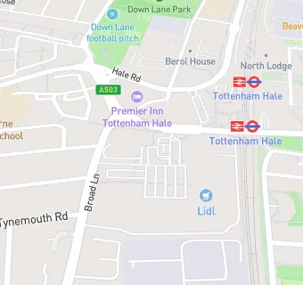
map for Boots

Near Boots

  1. Retail Stores
  2. Halfords, N154QD
  3. ★★★★★Poundland, N154QD
  4. 0.1 miles ★★★★★B&M Store, N154QD
  5. 0.1 miles ★★★★★WHSmith, N179NA
  6. 0.1 miles ★★★★★Greggs PLC, N179LR
  7. 0.1 miles ★★★★★High Cross Supermarket, N179NU
  8. 0.1 miles Currys PC World, N154QD
  9. 0.2 miles Shots Fired Ltd, N154QN
  10. Restaurants & Cafés
  11. ★★★★★Greggs, N154QD
  12. ★★★★★Subway, N154QD
  13. ★★★★★Costa Coffee, N154QD
  14. ★★★★★Burger King, N154QD
  15. 0.1 miles ★★★★★Deluxe Manna, N179NU
  16. Supermarkets
  17. Asda Living Store, N154QD
  18. ★★★★★Iceland Foods Limited, N154QD
  19. Chemists
  20. Boots, N154QD
  21. Schools All Through
  22. 0.3 miles Harris Academy Tottenham, N179LN (1310 pupils)
  23. Schools Primary
  24. 0.2 miles Welbourne Primary School, N154EA (468 pupils)
  25. 0.2 miles Ferry Lane Primary School, N179PP (152 pupils)
  26. 0.3 miles Holy Trinity CofE Primary School, N179EJ (177 pupils)
  27. 0.4 miles Earlsmead Primary School, N154PW (466 pupils)