BLOCLEats

Bright Stars

Era Site
Cleeve Road
Business Park 5 Research Area
KT227SA

Food rating: ★★★★★ 5/5 stars
Updated: 7. December 2023

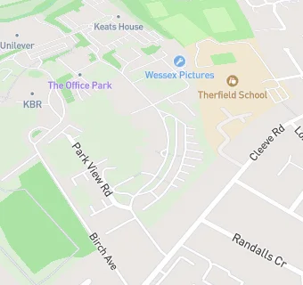
map for Bright Stars

Near Bright Stars

  1. Care Facilities
  2. 0.2 miles★★★★★Hartfield House Care Home, KT227GQ
  3. 0.4 milesMy Time for Young Carers, KT227RB
  4. 0.7 miles★★★★★Fairfield Day Centre, KT228AH
  5. 0.8 miles★★★★★Signature Dining @ Queen Elizabeth Foundation, KT220BT
  6. 0.9 miles★★★★★Combat Stress, KT220BX
  7. 0.9 miles★★★★★The Beeches, KT228RZ
  8. 1.0 mile★★★★★Bellsgrove Residential Care, KT229JF
  9. 1.0 mile★★★★The Pantiles Care Home Ltd, KT212QE
  10. Restaurants & Cafés
  11. 0.2 miles★★★★★Cafe One, KT227NL
  12. 0.3 miles★★★★★Sodexo at Unilever, KT227GR
  13. 0.3 miles★★★★★Dine Contract Catering, KT227LP
  14. 0.3 miles★★★★★Malai Thai, KT227SP
  15. 0.3 miles★★★★★Baxter Storey Ltd, KT227LP
  16. School Food Ratings
  17. 0.2 miles★★★★★The Learning Experience,
  18. 0.2 milesTheirfield School, KT227NZ
  19. Takeaway Shops
  20. 0.3 miles★★★★★The Lemon Plaice, KT227PB
  21. Schools
  22. 0.4 milesFox Grove School, KT227PW (133 pupils)
  23. 0.4 milesWest Hill School, KT227PW (149 pupils)
  24. 0.8 milesSt John's School, KT228SP (853 pupils)
  25. Schools Primary
  26. 0.4 milesLeatherhead Trinity School and Nursery, KT227BP (362 pupils)
  27. Schools Secondary
  28. 0.2 milesTherfield School, KT227NZ (1063 pupils)

See all Care Facilities in Leatherhead.