BLOCLEats

Bristol City Council

Social And Sports Club
Nibley Road
Shirehampton
Bristol
BS119XW

Food rating: ★★★★ 4/5 stars
Updated: 24. August 2024

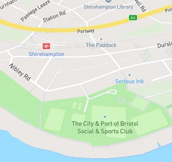
map for Bristol City Council

Near Bristol City …

  1. Bars & Nightclubs
  2. 0.2 miles★★★The Lamplighters, BS119XA
  3. 0.5 miles★★★★★Lodway Cricket Club, BS200HF
  4. 0.5 miles★★★★★The George Inn, BS110DP
  5. 0.6 miles★★★★Shirehampton Mens Club, BS110DG
  6. 0.6 miles★★★★★Shirehampton Park Golf Club Ltd, BS110UL
  7. 0.9 miles★★★★★Hope & Anchor, BS110AW
  8. 1.0 mile★★★★Avonmouth Bowling Club, BS119NG
  9. 1.0 mile★★★★★Avonmouth Old Boys RFC, BS119NG
  10. Care Facilities
  11. 0.3 miles★★★★Avon Autistic Foundation, BS119EQ
  12. 0.4 milesThe Nursery on the Green, BS200BX
  13. Catering Services
  14. 0.3 miles★★★★★Cotswold Community Centre, BS119XH
  15. Retail Stores
  16. 0.4 milesLloyds Pharmacy, BS119SB
  17. School Food Ratings
  18. 0.3 miles★★★★★Chartwells, BS119TU
  19. Takeaway Shops
  20. 0.4 miles★★★Curry House, BS200BG
  21. Dentists
  22. 0.3 milesTaneja And Pangotra Partnership, BS200DD
  23. 0.3 milesShirehampton Dental Practice, BS119TU
  24. Schools Primary
  25. 0.3 milesSt Bernard's Catholic Primary School, BS119TU (205 pupils)
  26. 0.5 milesShirehampton Primary School, BS119RR (504 pupils)
  27. 0.7 milesCrockerne Church of England Primary School, BS200JP (321 pupils)
  28. Schools Secondary
  29. 0.6 milesSt Katherine's School, BS200HU (1007 pupils)
  30. 0.6 milesOasis Academy Brightstowe, BS110EB (749 pupils)

See all Bars & Nightclubs in Bristol.