BLOCLEats

Brookhouse/KTown/FlusterCluck/Locked&Loaded

467 Smithdown Road
Liverpool
L155AE

Food rating: ★★★★★ 5/5 stars
Updated: 21. February 2019

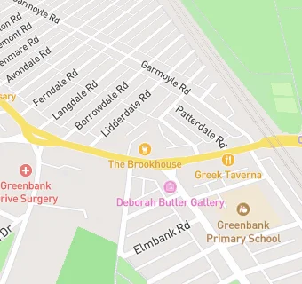
map for Brookhouse/KTown/FlusterCluck/Locked&Loaded

Near Brookhouse/KTown/FlusterCluck/Locked&Loaded

  1. Bars & Nightclubs
  2. ★★★★★Handymans Supermarket, L153JL
  3. ★★★Chamber 36 Smithdown, L155AE
  4. ★★★★★Dirty Nellies, L155AE
  5. 0.2 miles ★★★★★Franks, L153JT
  6. 0.2 miles ★★★★★The Beeswing, L153JT
  7. 0.3 miles ★★★★★Foghertys, L181EH
  8. 0.4 miles ★★★★Dovedale Towers, L181DG
  9. 0.4 miles ★★★★Willow Bank, L153JA
  10. Restaurants & Cafés
  11. 0.1 miles Epicerie Fine, L153JL
  12. Retail Stores
  13. Coco Baroque, L155AH
  14. ★★★★★Decent Donuts, L155AH
  15. ★★★★★Shell Petrol Station, L155AH
  16. Supermarkets
  17. ★★★★★Tesco Express, L155AH
  18. Takeaway Shops
  19. Greenbank Fish Bar, L155AH
  20. Siddiki, L155AH
  21. ★★★★★Pizza Hut, L155AH
  22. Schools Primary
  23. 0.1 miles Greenbank Primary School, L181JB (454 pupils)
  24. 0.4 miles St Clare's Catholic Primary School, L150DW (199 pupils)
  25. 0.5 miles Dovedale Community Primary School, L181JX (835 pupils)
  26. Schools Secondary
  27. 0.5 miles St Hilda's Church of England High School, L173AL (1122 pupils)
  28. 0.5 miles The Blue Coat School, L159EE (1252 pupils)