BLOCLEats

Chesterfield Foodbank (Hasland)

African Caribbean Community Association
Penmore Business Suite
Unit 2 Saxton Close Hasland
Chesterfield
S41

Food rating: ★★★★★ 5/5 stars
Updated: 27. February 2023

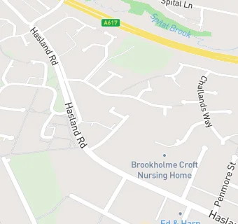
map for Chesterfield Foodbank (Hasland)

Near Chesterfield Foodbank …

  1. Retail Stores
  2. 0.2 miles ★★★★Penmore Stores, S410AG
  3. 0.3 miles ★★★★★One Stop (Hasland Road), S410AQ
  4. 0.3 miles ★★★★★King Candy, S410LJ
  5. 0.3 miles Lloyds Pharmacy - 18 The Green, S410LJ
  6. 0.4 miles ★★★★★CKs Fruit Veg and Flowers, S410JA
  7. 0.4 miles ★★★★★Hawkes & Co, S410JA
  8. 0.5 miles ★★★★★Spar Mansfield Road, S410JF
  9. 0.6 miles Singhs Wine & Food Store/Premier, S402ES
  10. Care Facilities
  11. ★★★★★Amazing Acorns, S410SJ
  12. 0.1 miles ★★★★★Brookholme Croft Nursing Home, S410EU
  13. 0.2 miles ★★★★★Little Tykes Kids Zone, S410PF
  14. Catering Services
  15. ★★★★★Saffron Kitchen (Asian Association of Chesterfield and N. Derbyshire), S410SJ
  16. 0.2 miles ★★★★★Hasland Baptist Church - Church Hall, S410PF
  17. 0.2 miles Hasland Baptist Church, S410PF
  18. Restaurants & Cafés
  19. S1 Framing and Art, S410SJ
  20. Takeaway Shops
  21. 0.3 miles ★★★★★Kates Pantry, S410JA
  22. Schools
  23. 0.5 miles Esteem North Academy, S410LN (228 pupils)
  24. Schools Primary
  25. 0.2 miles Hasland Infant School, S410PE (344 pupils)
  26. 0.6 miles Spire Nursery and Infant School, S402EU (183 pupils)
  27. 0.6 miles Spire Junior School, S402EN (188 pupils)
  28. Schools Secondary
  29. 0.5 miles Outwood Academy Hasland Hall, S410LP (820 pupils)