BLOCLEats

Co-operative

72 Sharman Court
Broad Lane
Sheffield
S14FA

Food rating: ★★★★★ 5/5 stars
Updated: 1. December 2018

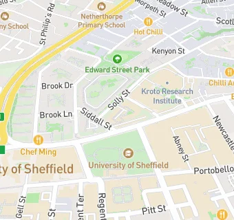
map for Co-operative

Near Co-operative

  1. Supermarkets
  2. 0.2 miles★★★★★Tesco Stores Ltd, S14GB
  3. 0.3 miles★★★★★Tesco Express (4530), S14GN
  4. 0.4 miles★★★★★Tesco Stores Limited, S12HE
  5. 0.6 miles★★★★★Poundland PLC, S12GF
  6. 0.6 miles★★★★★Tesco Stores Ltd, S38RA
  7. 0.7 miles★★★★Budgens - The Forge, S24LA
  8. 0.8 miles★★★★★Marks & Spencer Simply Food, S12BP
  9. 0.8 miles★★★★★Many Mart, S24QE
  10. Food Trucks
  11. 0.1 miles★★★★★Students Union Food Van, S37RD
  12. Restaurants & Cafés
  13. ★★★★★North Campus Cafe, S37HQ
  14. 0.1 miles★★★★★The Jessop Cafe, S37RA
  15. 0.1 miles★★★★★Heartspace Cafe, S13JD
  16. 0.1 miles★★★★★Sheffield Royal Society for the Blind, S14DT
  17. 0.1 miles★★★★★Sheffield Trading Services (Unicus), S37RD
  18. School Food Ratings
  19. 0.2 miles★★★★★Waterfall Elior, S37JA
  20. Doctors
  21. 0.1 milesNhs Walk-In Centre, S13PB
  22. Schools
  23. 0.3 milesBethany School, S37PS (92 pupils)
  24. 0.4 milesUniversity of Sheffield, S102TN
  25. Schools Nursery
  26. 0.6 milesBroomhall Nursery School, S102DN (96 pupils)
  27. Schools Primary
  28. 0.2 milesNetherthorpe Primary School, S37JA (258 pupils)
  29. 0.3 milesSpringfield Primary School, S37RZ (202 pupils)

See all Supermarkets in Sheffield.