BLOCLEats

Co-operative Group

280 Knutsford Road
Warrington
WA41AZ

Food rating: ★★★★★ 5/5 stars
Updated: 25. April 2024

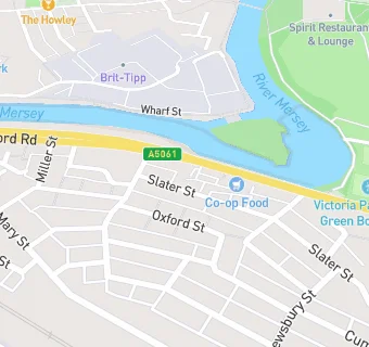
map for Co-operative Group

Near Co-operative Group

  1. Supermarkets
  2. 0.5 miles★★★★★Lidl Great Britain Ltd, WA12PA
  3. 0.6 miles★★★★★Farmfoods, WA12TA
  4. 0.7 miles★★★★★Asda Stores Ltd, WA12QA
  5. 0.8 miles★★★★★Lidl Great Britain Ltd, WA41LW
  6. 0.8 miles★★★★★Co op, WA41JR
  7. 0.8 miles★★★★★Marks & Spencer Simply Foods, WA46HW
  8. 1.0 mile★★★★★Aldi Stores Ltd, WA11UP
  9. 1.0 mile★★★★★Iceland Frozen Foods Ltd, WA11UP
  10. Care Facilities
  11. 0.2 miles★★★★★Kent Street Community Church, WA41BT
  12. Bars & Nightclubs
  13. 0.1 miles★★★★★Kings Club, WA41BH
  14. Restaurants & Cafés
  15. 0.2 miles★★★★★Jellybeans Play Centre Ltd, WA12HT
  16. 0.2 miles★★★★★JJ's Blooming Baps, WA12DG
  17. 0.3 miles★★★★★Spirit, WA41DQ
  18. Retail Stores
  19. 0.2 milesWarrington Gymnastics Club, WA12HT
  20. 0.3 miles★★★★★B & M Home Store, WA12GZ
  21. 0.3 milesHalfords, WA12GZ
  22. Schools
  23. 0.6 milesWillow Green CIO, WA46DQ
  24. Schools 16 Plus
  25. 0.3 milesPriestley College, WA46RD
  26. Schools Primary
  27. 0.4 milesLatchford St James CofE Primary School, WA41AP (184 pupils)
  28. 0.5 milesOur Lady's Catholic Primary School, a Voluntary Academy, WA41JD
  29. 0.6 milesSt Elphin's (Fairfield) CofE Voluntary Aided Primary School, WA12GN (368 pupils)

See all Supermarkets in Warrington.