BLOCLEats

Co-Operative Group

24 High Street
Benson
WALLINGFORD
OX106RP

Food rating: ★★★★★ 5/5 stars
Updated: 18. June 2024

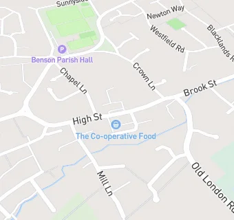
map for Co-Operative Group

Near Co-Operative Group

  1. Supermarkets
  2. 1.6 miles★★★★★Waitrose, OX100EF
  3. 2.1 miles★★★★★Lidl, OX109BS
  4. 3.1 miles★★★★★Midcounties Cooperative, OX107HN
  5. 3.7 miles★★★★★Tesco Express, OX109NT
  6. 4.2 miles★★★★Midcounties Cooperative, OX107ND
  7. 5.0 miles★★★★★Tesco Superstore, OX119BZ
  8. 5.4 miles★★★★★Aldi Stores Ltd, OX118ET
  9. 5.7 miles★★★★★Sainsburys, OX117ND
  10. Bars & Nightclubs
  11. ★★★★The Crown Inn, OX106RP
  12. Restaurants & Cafés
  13. ★★★★★No. 25 Benson Ltd, OX106RP
  14. Retail Stores
  15. ★★★Benson Village Butcher, OX106RP
  16. Takeaway Shops
  17. ★★★Spice Garden Benson Ltd, OX106RP
  18. ★★★★★The Village Plaice, OX106RP
  19. Chemists
  20. Benson Pharmacy, OX106RP
  21. Doctors
  22. Mill Stream Surgery, OX106RL
  23. Mill Stream Surgery, OX106RL
  24. Schools Primary
  25. 0.2 milesBenson Church of England Primary School, OX106LX (291 pupils)
  26. 1.2 milesRAF Benson Community Primary School, OX106EP (154 pupils)
  27. 1.5 milesSt Nicholas' Church of England Infants' School and Nursery Class, Wallingford, OX108HX (175 pupils)
  28. 1.6 milesSt Laurence Church of England School, OX107DX (93 pupils)
  29. Schools Secondary
  30. 1.4 milesWallingford School, OX108HH (1411 pupils)

See all Supermarkets in Benson.