BLOCLEats

Cranham Convenience Store

Moor Lane
Upminster
RM141DZ

Food rating: ★★★★ 4/5 stars
Updated: 5. March 2018

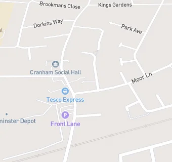
map for Cranham Convenience Store

Near Cranham Convenience …

  1. Retail Stores
  2. ★★★★★Cranham Village Bakery, RM141DY
  3. Cranham Wines, RM141EB
  4. ★★★★Fags & Mags, RM141DZ
  5. 0.1 miles Govani Chemist, RM141XN
  6. 0.1 miles ★★★★★Village Bakery, RM141XN
  7. 0.3 miles ★★★★★Ians Confectionery, RM141BN
  8. 0.5 miles ★★★★★Upminster Fruit & Veg, RM141RQ
  9. 0.5 miles ★★★★★Avon Road Convenience Store, RM141RQ
  10. Care Facilities
  11. ★★★★★Lottie & Ollie Day Nursery, RM141DY
  12. Bars & Nightclubs
  13. ★★★★★The Plough, RM141XL
  14. Restaurants & Cafés
  15. ★★★★★Sodexo @ TFL Upminster, RM141XL
  16. ★★★★Spice of India, RM141XJ
  17. ★★★★★Cafe in Cranham, RM141XJ
  18. Supermarkets
  19. ★★★★★Tesco Express, RM141XL
  20. Takeaway Shops
  21. Prosperity Chinese Takeaway, RM141XL
  22. ★★★★★Sea World, RM141DZ
  23. Schools Primary
  24. 0.4 miles The James Oglethorpe Primary School, RM143NB (391 pupils)
  25. 0.6 miles Engayne Primary School, RM141SW (605 pupils)
  26. 0.9 miles St Joseph's Catholic Primary School, RM142QB (420 pupils)
  27. Schools Secondary
  28. 0.3 miles Hall Mead School, RM141SF (1069 pupils)
  29. 0.5 miles The Coopers' Company and Coborn School, RM143HS (1567 pupils)