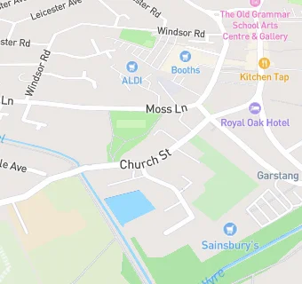
BLOCLEats

Farmers Arms

18 Church Street
Garstang
Preston
Lancashire
PR31PA

Food rating: ★★★★★ 5/5 stars
Updated: 19. November 2024

map for Farmers Arms

Near Farmers Arms

  1. Bars & Nightclubs
  2. ★★★★Th'owd Tithebarn, PR31PA
  3. 0.1 milesThe Wheatsheaf, PR31EL
  4. 0.1 miles★★★The Royal Oak, PR31ZA
  5. 0.1 miles★★★★★The Garstang Club Ltd, PR31ZA
  6. 0.2 milesNineteen Kitchen And Bar, PR31FA
  7. 0.2 miles★★★★★Kings Arms Hotel, PR31EA
  8. 0.2 miles★★★★★The Crown Hotel Garstang, PR31FA
  9. 0.2 miles★★★★★Garstang Sports & Social Club, PR31FA
  10. Care Facilities
  11. ★★★★★Abbeyfield House, PR31PA
  12. Restaurants & Cafés
  13. ★★★★★Royal Voluntary Service Lunch Club, PR31PA
  14. ★★★★★St Thomas, PR31PA
  15. 0.1 miles★★★★Thai Courtyard, PR31LN
  16. 0.1 miles★★★★V12 Bistro Bar, PR31HF
  17. 0.1 miles★★★★★Cafe Mila, PR31YA
  18. Retail Stores
  19. 0.1 milesMarket Place News, PR31ZA
  20. 0.1 miles★★★★★Garstang Quality Meats, PR31ZA
  21. Schools Primary
  22. 0.3 milesSt Mary and Michael Catholic Primary School, PR31RB (102 pupils)
  23. 0.3 milesGarstang St Thomas' Church of England Primary School, PR31PB (255 pupils)
  24. 0.5 milesGarstang Community Primary School, PR31HT (204 pupils)
  25. 1.3 milesKirkland and Catterall St Helen's Church of England Voluntary Aided Primary School, PR30HS (159 pupils)
  26. Schools Secondary
  27. 0.8 milesGarstang Community Academy, PR31YE (819 pupils)

See all Bars & Nightclubs in Garstang.