BLOCLEats

Grain and Vine

The Wheatsheaf
St Nicholas Road
West Boldon
Tyne & Wear
NE360QR

Food rating: AwaitingInspection
Updated: N/A
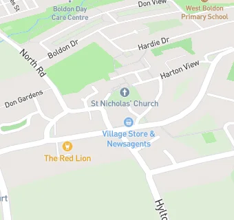
map for Grain and Vine

Near Grain and …

  1. Bars & Nightclubs
  2. 0.1 miles ★★★★The Black Horse, NE360QQ
  3. 0.1 miles ★★★★The Red Lion Inn, NE360PZ
  4. 0.4 miles ★★★★★The Travelling Man, NE360BQ
  5. 0.6 miles ★★★★★The Storybook, NE359PB
  6. 0.6 miles ★★★★The Shack, NE359AL
  7. 0.7 miles ★★★★★Black Bull, NE360SG
  8. 0.7 miles ★★★★★The Flat Tops/Old Barrell, NE359AF
  9. 0.8 miles ★★★★★The Grey Horse Inn, NE360SJ
  10. Food Trucks
  11. 0.3 miles The Black Box, NE360NH
  12. 0.4 miles ★★★★★Zach American Candy, NE359AX
  13. Retail Stores
  14. ★★★★★West Boldon Post Office, NE360RA
  15. 0.4 miles ★★★★★Simply Pour and Make, NE359DT
  16. Supermarkets
  17. 0.4 miles ★★★★★Heron Foods, NE359AU
  18. School Food Ratings
  19. 0.3 miles ★★★★★West Boldon County Jmi, NE360HX
  20. Takeaway Shops
  21. ★★★★★Ali's House of Pizza, NE360QR
  22. Chemists
  23. 0.4 miles Cohens Chemist, NE359AU
  24. Schools Nursery
  25. 0.4 miles Boldon Nursery School, NE359DG (95 pupils)
  26. Schools Primary
  27. 0.3 miles West Boldon Primary School, NE360HX (259 pupils)
  28. 0.8 miles St John Bosco Catholic Primary School, Town End Farm, Sunderland, SR54JW (202 pupils)
  29. 0.9 miles Hedworth Lane Primary School, NE359JB (283 pupils)
  30. Schools Secondary
  31. 0.6 miles Boldon School, NE359DZ (1056 pupils)