BLOCLEats

Hambleton Play Safe

Community Centre
Old Vicarage Lane
Monk Fryston
North Yorkshire
LS255EA

Food rating: ★★★★★ 5/5 stars
Updated: 20. February 2024

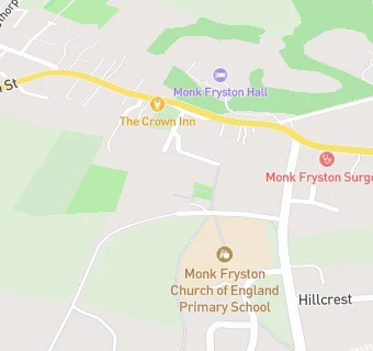
map for Hambleton Play Safe

Near Hambleton Play …

  1. School Food Ratings
  2. 0.1 miles★★★★★Monk Fryston C E P School, LS255PN
  3. 1.3 miles★★★★★South Milford C P School, LS255AU
  4. 1.6 miles★★★★★Burton Salmon CP School, LS255JY
  5. 2.0 miles★★★★★Athelstan C P School, LS256AY
  6. 2.3 miles★★★★★Sherburn High School, LS256AS
  7. 2.3 miles★★★★★Fairburn CP School, WF119JY
  8. 2.9 miles★★★★★Brotherton & Byram C P School, WF119HQ
  9. 3.1 miles★★★★★Hambleton C E School, YO89HP
  10. Care Facilities
  11. 0.7 miles★★★★★Playsafe, LS255HP
  12. Food Trucks
  13. 1.4 miles★★★★★Hog Roast Yorkshire, LS255AR
  14. Catering Services
  15. 1.2 miles★★★★★The Maltings Tearoom, LS255BX
  16. Restaurants & Cafés
  17. 0.1 miles★★★★★The Crown Inn, LS255DU
  18. 0.5 miles★★★★★The Cross Keys, LS255HE
  19. Retail Stores
  20. 0.5 miles★★★★★Bert's Barrow, LS255NQ
  21. 1.2 miles★★★★★BP Oil Uk Ltd, LS255AS
  22. Doctors
  23. 0.2 milesMonk Fryston Surgery, LS255EG
  24. Schools Primary
  25. 0.1 milesMonk Fryston Church of England Primary School, LS255PN (203 pupils)
  26. 1.3 milesSouth Milford Primary School, LS255AU (201 pupils)
  27. 1.6 milesBurton Salmon Community Primary School, LS255JY
  28. 2.0 milesSherburn in Elmet, Athelstan Community Primary School, LS256QN (502 pupils)
  29. Schools Secondary
  30. 2.3 milesSherburn High School, LS256AS (857 pupils)

See all School Food Ratings in Monk Fryston.