BLOCLEats

High Farm

Farrar Lane
Adel
Leeds
LS167AQ

Food rating: ★★★★ 4/5 stars
Updated: 20. June 2024

Food ratings

Confidence in management: 5
Hygiene: 5
Structural: 10
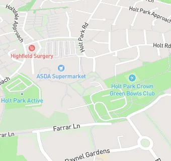
map for High Farm

Near High Farm

  1. Bars & Nightclubs
  2. 0.5 miles★★★★★Bannatyne Cookridge Hall, LS167NL
  3. 0.7 miles★★★★★Adel War Memorial Association Ltd, LS168DE
  4. 0.8 miles★★★★★Cookridge Cricket Club, LS167LY
  5. 0.9 miles★★★★★Lawnswood Red Triangle, LS166HQ
  6. 1.0 mile★★★★★Tinshill And Cookridge Club And Institute, LS166PF
  7. 1.0 mile★★★★★Yeadon Catering, LS168DW
  8. 1.1 miles★★★★Old Modernians Association, LS167ND
  9. 1.1 miles★★★★★Fox And Hounds (Cookridge), LS167BT
  10. Supermarkets
  11. 0.1 miles★★★★★Asda (Holt Park), LS167RY
  12. School Food Ratings
  13. 0.1 miles★★★★★Chartwells (Ralph Thoresby), LS167RX
  14. 0.1 miles★★★★★Ireland Wood Primary School, LS166BW
  15. Chemists
  16. 0.1 milesCohens Chemist, LS167RX
  17. Dentists
  18. 0.1 milesThe Parade Dental, LS167SR
  19. 0.1 milesThe Parade Dental, LS167SR
  20. Doctors
  21. 0.1 milesHighfield Surgery, LS167RX
  22. 0.1 milesHigh Field Surgery, LS167RX
  23. Schools
  24. 0.8 milesLighthouse School Leeds, LS166QB (88 pupils)
  25. Schools Primary
  26. 0.2 milesIreland Wood Primary School, LS166BW (418 pupils)
  27. 0.4 milesCookridge Primary School, LS167DH (313 pupils)
  28. 0.6 milesHoly Name Catholic Voluntary Academy, LS166NF (204 pupils)
  29. Schools Secondary
  30. 0.1 milesRalph Thoresby School, LS167RX (1035 pupils)

See all Bars & Nightclubs in Leeds.