BLOCLEats

Hutton All Saints Scout Group

Wash Road
Hutton
Brentwood
Essex
CM131BS

Food rating: ★★★★★ 5/5 stars
Updated: 21. November 2018

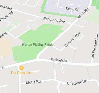
map for Hutton All Saints Scout Group

Near Hutton All …

  1. Bars & Nightclubs
  2. 0.1 miles★★★★★The Chequers, CM131PJ
  3. 0.8 miles★★★Vault, CM158SD
  4. 0.9 miles★★★★★Mount Avenue Banqueting Suite, CM132NS
  5. 0.9 miles★★★★★The Hutton Junction, CM131AB
  6. 1.1 miles★★★★★Hollands Wine Bar, CM158PA
  7. 1.2 miles★★★★The Rose, CM158RN
  8. 1.3 miles★★★★★The George And Dragon, CM150TZ
  9. 1.4 miles★★★★★Shenfield Cricket Club, CM158RQ
  10. Food Trucks
  11. 0.1 miles★★★★The Best Kebab - Hutton, CM131PJ
  12. Restaurants & Cafés
  13. 0.1 miles★★★★★HCC Coffee Shop, CM131LP
  14. 0.1 miles★★★★★The Coffee Pot, CM131LP
  15. 0.1 miles★★★★★Coffee Pot, CM131LP
  16. Retail Stores
  17. 0.1 milesWell Ltd, CM131LZ
  18. 0.1 miles★★★★★Hutton Shopper, CM131PN
  19. Takeaway Shops
  20. 0.1 miles★★★★★Essex Grill 5, CM131PN
  21. Chemists
  22. 0.1 milesWell, CM131LZ
  23. Schools
  24. 0.8 milesWoodlands School Hutton Manor, CM131SD (171 pupils)
  25. Schools Primary
  26. 0.2 milesHutton All Saints' Church of England Primary School, CM131JW (211 pupils)
  27. 0.3 milesWillowbrook Primary School, CM132TU (213 pupils)
  28. 0.4 milesSt Joseph the Worker Catholic Primary School, CM131BJ (210 pupils)
  29. 0.7 milesLong Ridings Primary School, CM131DU (390 pupils)

See all Bars & Nightclubs in Brentwood.