BLOCLEats

Labour Social Club

Ellesmere Port And District Labour Social Club Flatt Lane
Ellesmere Port
Cheshire
CH658DP

Food rating: ★★★★★ 5/5 stars
Updated: 19. July 2017

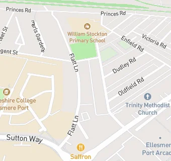
map for Labour Social Club

Near Labour Social …

  1. Bars & Nightclubs
  2. 0.2 miles★★★★william jessop, CH658AB
  3. 0.3 milesMadisons Cafe Bar, CH658EU
  4. 0.6 miles★★★★★Ellesmere Port Conservative Club, CH652ET
  5. 0.7 miles★★★★★The Cat, CH655BZ
  6. 0.7 miles★★★★★Horse and Jockey, CH654DH
  7. 0.8 miles★★★★★The Wheatsheaf, CH663LN
  8. 1.1 milesGunners Arms Stanney Grange, CH655HN
  9. 1.1 miles★★★★★The Woodlands Hotel, CH662LJ
  10. Restaurants & Cafés
  11. 0.1 miles★★★★★Brooke's, CH658DP
  12. 0.1 miles★★★★★Club 3000 Bingo, CH650AN
  13. Retail Stores
  14. 0.1 miles★★★Heathfield Convenience Store, CH658DJ
  15. School Food Ratings
  16. ★★★★★William Stockton Community School, CH658DH
  17. ★★★★★William Stockton Primary Out of School Club, CH658DH
  18. 0.1 miles★★★★★Academy West, CH657BF
  19. Takeaway Shops
  20. 0.1 miles★★★★★Subway, CH650AN
  21. 0.1 miles★★★★★Wok & Go / MAX, CH650AN
  22. Schools Primary
  23. 0.1 milesWilliam Stockton Community Primary School, CH658DH (358 pupils)
  24. 0.3 milesCambridge Road Community Primary and Nursery School, CH654AQ (250 pupils)
  25. 0.4 milesWestminster Community Primary School, CH652ED (133 pupils)
  26. 0.6 milesOur Lady Star of the Sea Catholic Primary School, CH657AQ (345 pupils)
  27. Schools Secondary
  28. 0.2 milesEllesmere Port Church of England College, CH656EA (633 pupils)

See all Bars & Nightclubs in Ellesmere Port Town.