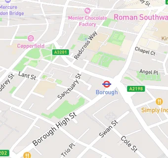
BLOCLEats

Lant street

First Floor
59-61
Lant Street
London
SE11QN

Food rating: ★★★★★ 5/5 stars
Updated: 4. October 2019

map for Lant street

Near Lant street

  1. Bars & Nightclubs
  2. 0.1 miles★★★★★The lord clyde, SE11ER
  3. 0.2 miles★★★★★Italian beer company connection limtied, SE16DR
  4. 0.2 miles★★★Royal oak, SE14JU
  5. 0.2 miles★★★★★Rose & crown, SE11SG
  6. 0.2 miles★★★★★Ethika, SE16DR
  7. 0.2 miles★★★★★Great guns social, SE10EF
  8. 0.3 miles★★★★★The miller, SE13SS
  9. 0.3 miles★★★★★Katzenjammers, SE11TY
  10. Care Facilities
  11. 0.1 miles★★★★The outside project - divine fridge, SE11QP
  12. Food Trucks
  13. 0.1 miles★★★★Mexican street / paella street, SE11JA
  14. Restaurants & Cafés
  15. ★★★★Rice coming noodle bar, SE11JX
  16. ★★★★★German doner kebab, SE11JX
  17. ★★★★★St john bakery, SE11LB
  18. ★★★★★Prezzemolo & vitale, SE11LB
  19. Retail Stores
  20. Lant street wine company, SE11QN
  21. Supermarkets
  22. ★★★Borough supermarket, SE11JX
  23. Schools
  24. 0.1 milesLondon Christian School, SE14JU (118 pupils)
  25. Schools Primary
  26. 0.1 milesCharles Dickens Primary School, SE11AF (475 pupils)
  27. 0.1 milesSaint Joseph's Catholic Primary School, the Borough, SE11NJ (176 pupils)
  28. 0.1 milesThe Cathedral School of St Saviour and St Mary Overie, SE11HG (213 pupils)
  29. Schools Secondary
  30. 0.2 milesHaberdashers' Borough Academy, SE10EX (863 pupils)

See all Bars & Nightclubs in London.