BLOCLEats

Light House Community Group CIO

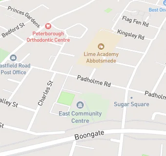
East Community Complex
Padholme Road
Eastfield
Peterborough
PE15EN

Food rating: ★★★★★ 5/5 stars
Updated: 25. July 2022

map for Light House Community Group CIO

Near Light House …

  1. Restaurants & Cafés
  2. 0.2 miles★★★★★Caribbean Millennium Centre, PE15GD
  3. 0.2 miles★★★★★Peterborough Bowls Club, PE15HA
  4. 0.4 miles★★★★★Coffee Shop, PE11TU
  5. 0.4 miles★★★★★The Willow Cafe, PE14DX
  6. 0.4 milesPolish Shop Ltd, PE15DD
  7. 0.4 miles★★★★★Pizza Hut Restaurants – Dine In, PE15YA
  8. 0.5 milesMarshall Land Rover Peterborough, PE15AU
  9. 0.5 miles★★★★★Parrotts Fish and Chips, PE11TB
  10. Catering Services
  11. 0.3 miles★★★★★The Chestnuts Comm Centre CIO, PE15LD
  12. Retail Stores
  13. 0.2 miles★★★★★RCCG City of Grace Peterborough Food Bank, PE15DU
  14. School Food Ratings
  15. ★★★★★Bright Bambini Montessori (Eastfield), PE15EN
  16. 0.1 miles★★★★★Lime Trust - Lime Academy Abbotsmede, PE15JS
  17. 0.3 miles★★★★★Caterlink @ NeneGate School, PE15GZ
  18. Takeaway Shops
  19. 0.1 miles★★★★★Pizza King, PE15JB
  20. Chemists
  21. 0.2 milesMi Pharmacy (Eastfield Road Branch), PE14AU
  22. Dentists
  23. 0.3 milesBupa Dental Care, Peterborough Broadway, PE14DD
  24. Schools
  25. 0.3 milesNeneGate, PE15GZ (64 pupils)
  26. Schools Primary
  27. 0.1 milesLime Academy Abbotsmede, PE15JS (461 pupils)
  28. 0.4 milesSt Thomas More Catholic Primary School, PE15JW (412 pupils)
  29. Schools Secondary
  30. 0.4 milesSt John Fisher Catholic High School, PE15JN (796 pupils)
  31. 0.4 milesThe King's (The Cathedral) School, PE12UE (1251 pupils)

See all Restaurants & Cafés in Peterborough.