BLOCLEats

Lincolnshire Cooperative Limited

2 Hetts Lane
Warsop
Nottinghamshire
NG200AS

Food rating: ★★★★ 4/5 stars
Updated: 8. June 2023

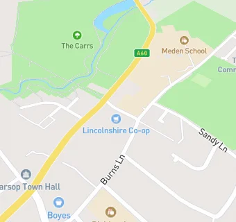
map for Lincolnshire Cooperative Limited

Near Lincolnshire Cooperative …

  1. Supermarkets
  2. 0.2 miles★★★★Co-operative Group, NG200AA
  3. 2.6 miles★★★★★Lidl, NG208TY
  4. 2.6 miles★★★★The Co-operative Food, NG208AQ
  5. 2.7 miles★★★★★Aldi, NG208PE
  6. 3.0 miles★★★★★Tesco Express, NG199HZ
  7. 3.4 miles★★★★★Morrisons, NG198AN
  8. 3.4 miles★★★★★Farmfoods Ltd, NG198AN
  9. 3.5 miles★★★★★Coop, NG219AA
  10. Care Facilities
  11. 0.1 miles★★★★★Voyage Care, NG200AU
  12. Food Trucks
  13. 0.1 miles★★★★★Box Kitchen/Allotment Box, NG200AU
  14. Bars & Nightclubs
  15. ★★★★★The Plough Inn, NG200AR
  16. Retail Stores
  17. 0.1 miles★★★★★Mike Maloney Butchers, NG200PB
  18. 0.1 miles★★★★★W Boyes & Co Ltd, NG200AH
  19. School Food Ratings
  20. ★★★★★Hetts Lane Nursery & Infants School, NG200AS
  21. Takeaway Shops
  22. 0.1 miles★★★★Spice Cottage and Family Limited, NG200PB
  23. 0.1 milesSmoak, NG200AX
  24. Schools Primary
  25. Hetts Lane Infant and Nursery School, NG200AS (172 pupils)
  26. 0.1 milesBirklands Primary School, NG200QF (316 pupils)
  27. 0.4 milesSherwood Junior School, NG200JT (199 pupils)
  28. 0.7 milesChurch Vale Primary School and Foundation Unit, NG200TE (225 pupils)
  29. Schools Secondary
  30. 0.1 milesMeden School, NG200QN (1075 pupils)

See all Supermarkets in Market Warsop.