BLOCLEats

Liverpool Alcohol Express

48 Mill Lane
Liverpool
L135TF

Food rating: ★★★★★ 5/5 stars
Updated: 6. March 2023

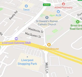
map for Liverpool Alcohol Express

Near Liverpool Alcohol …

  1. Logistics Providers
  2. 0.4 miles ★★★★Booker Cash & Carry, L131DH
  3. 0.6 miles Freshdayz, L133AS
  4. 1.1 miles Zagros cash & carry ltd, L152JJ
  5. 1.6 miles ★★★★New Delhi Cash and Carry,, L137JN
  6. 1.8 miles ★★★★★Beerscellars, L65AT
  7. 2.6 miles ★★★★★Rail Gourmet (RG), L11JD
  8. 2.6 miles ★★★★★DHL Service Centre, L11JD
  9. 3.4 miles The Indian Kitchen Liverpool, L199AQ
  10. Bars & Nightclubs
  11. 0.1 miles ★★★★★Brambles, L135SB
  12. Restaurants & Cafés
  13. ★★★★★Lappin's Cafe also trading as Bella Boo's Food Bar, L135TF
  14. Retail Stores
  15. ★★★★★Lets Get Tipsy, L135TF
  16. Supermarkets
  17. 0.2 miles ★★★★★Aldi, L135SG
  18. Takeaway Shops
  19. 0.2 miles ★★★★★Franky'z, L135SD
  20. 0.2 miles ★★★★★Safi's Desserts, L135XE
  21. Doctors
  22. 0.1 miles Rock Court Surgery, L132GA
  23. 0.1 miles Old Swan Health Centre, L132GA
  24. Schools Primary
  25. 0.1 miles St Oswald's Catholic Primary School, L135TE (629 pupils)
  26. 0.3 miles Broadgreen Primary, L135UE (229 pupils)
  27. 0.4 miles St Anne's (Stanley) Junior Mixed and Infant School, L133BT (411 pupils)
  28. 0.5 miles St Cuthbert's Catholic Primary and Nursery School, L132BA (241 pupils)
  29. 0.5 miles Northway Primary and Nursery School, L157JQ (401 pupils)