BLOCLEats

Londis

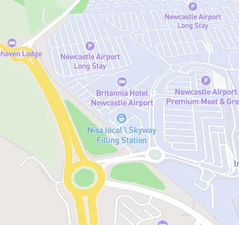
Skyway Filling Station Newcastle Airport
Newcastle Upon Tyne
NE138BZ

Food rating: ★★★★★ 5/5 stars
Updated: 7. June 2024

map for Londis

Near Londis

  1. Retail Stores
  2. 0.2 miles★★★★★W H Smith (Pier), NE138BZ
  3. 0.2 miles★★★★★W H Smith Express, NE138BZ
  4. 0.2 miles★★★★★W H Smith Landside, NE138BZ
  5. 0.2 milesWDFG UK LIMITED, NE138BZ
  6. 0.2 miles★★★★★Boots UK Ltd, NE138BZ
  7. 1.4 milesTaylors Pharmacy, NE209NZ
  8. 1.5 milesPonteland Post Office, NE209PY
  9. 1.5 miles★★★★★One Stop Stores Ltd, NE209PY
  10. Hotels & BnBs
  11. 0.1 miles★★★★★Newcastle Airport Premier Inn, NE209DB
  12. 0.1 miles★★★★★Doubletree By Hilton Hotel, NE138BZ
  13. 0.1 miles★★★★Britannia Hotel, NE138DJ
  14. 0.2 miles★★★★★Stone Haven Lodge Bed & Breakfast, NE209BX
  15. Bars & Nightclubs
  16. 0.2 miles★★★★★The Aspire Lounge, NE138BZ
  17. Restaurants & Cafés
  18. ★★★★★Costa, NE138BZ
  19. Takeaway Shops
  20. 0.2 miles★★★★★Greggs, NE138BZ
  21. 0.2 miles★★★★★Upper Crust, NE138BZ
  22. Schools
  23. 1.7 milesEmily Wilding Davison School, NE209QB (103 pupils)
  24. Schools Primary
  25. 1.2 milesPonteland Community Primary School, NE209EY (260 pupils)
  26. 1.7 milesPonteland Primary School, NE209EG (466 pupils)
  27. 1.7 milesRichard Coates Church of England Primary School, NE209QB (331 pupils)
  28. Schools Secondary
  29. 1.2 milesPonteland High School, NE209EG (1548 pupils)

See all Retail Stores in Newcastle upon Tyne.