BLOCLEats

Marks & Spencer

Trowell Services Area South
M1 Trowell Services Southbound Off Slip
Trowell
Nottinghamshire
NG93PL

Food rating: ★★★★★ 5/5 stars
Updated: 27. April 2021

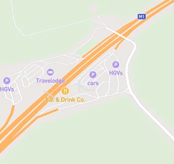
map for Marks & Spencer

Near Marks & …

  1. Retail Stores
  2. ★★★★★W H Smith, NG93PL
  3. ★★★★★Moto Petrol Station Including Greggs (Southbound), NG93PL
  4. 0.1 miles ★★★★★W H Smith, NG93PL
  5. 0.1 miles ★★★★★Moto BP Petrol Station Inc Greggs (Northbound), NG93QQ
  6. 0.7 miles ★★★★★Farm Shop, NG93PQ
  7. 0.9 miles ★★★★★Trowell Post Office, NG93QB
  8. 1.2 miles ★★★★★Old Fashioned Sweet Shop Strelley Hall, NG86PE
  9. 1.4 miles ★★★★★Stapleford Community Group, NG98LJ
  10. Hotels & BnBs
  11. 0.1 miles ★★★★★Travelodge, NG93PL
  12. Restaurants & Cafés
  13. 0.1 miles ★★★★★Greggs, NG93QQ
  14. 0.1 miles ★★★★★Burger King (Northbound), NG93PL
  15. 0.1 miles ★★★★★Burger King (Southbound M1 Trowell), NG93PL
  16. 0.1 miles ★★★★★KFC (Kentucky Fried Chicken), NG93PL
  17. 0.1 miles ★★★★★Costa Coffee, NG93PL
  18. Supermarkets
  19. 0.1 miles ★★★★★Marks & Spencer Simply Food, NG93PL
  20. Takeaway Shops
  21. ★★★★★Greggs, NG93PL
  22. Schools Primary
  23. 0.7 miles Trowell CofE Primary School, NG93QD (176 pupils)
  24. 1.1 miles Portland Spencer Academy, NG84HB (418 pupils)
  25. 1.1 miles Firbeck Academy, NG82FB (194 pupils)
  26. 1.4 miles Larklands Infant School, DE75DR (162 pupils)
  27. Schools Secondary
  28. 1.3 miles Nottingham University Samworth Academy, NG84HY (875 pupils)