BLOCLEats

Marston Court

Marston Road
Oxford
Oxfordshire
OX30DJ

Food rating: ★★★★★ 5/5 stars
Updated: 24. October 2024

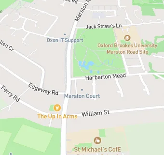
map for Marston Court

Near Marston Court

  1. Care Facilities
  2. 0.2 miles★★★★★The Catherine Wheel Nursery, OX30JA
  3. 0.2 miles★★★★★Brookes University Nursery, OX30TU
  4. 0.4 miles★★★★★Kids Planet Jack Straws, OX30DW
  5. 0.7 miles★★★★★Little Pioneer Co-operative Childcare John Radcliffe Nursery, OX39DU
  6. 0.7 miles★★★★★Abbeyfield Oxford Society, OX41AW
  7. 0.7 miles★★★★★The Albany Nursing Home, OX37SN
  8. 0.8 miles★★★★★The Parasol Project, OX39RG
  9. 0.8 miles★★★★★Churchill Hospital - Ward Kitchens, OX37JY
  10. Logistics Providers
  11. 0.2 milesWondaberry, OX30ES
  12. Bars & Nightclubs
  13. 0.1 miles★★★★★The Up In Arms,
  14. 0.3 miles★★★★★Marston Royal British Legion, OX30JW
  15. Restaurants & Cafés
  16. 0.2 miles★★★★★Gather And Gather, OX30FL
  17. Retail Stores
  18. 0.1 milesLondis, OX30EL
  19. School Food Ratings
  20. 0.1 milesOxfordshire County Council, OX30EJ
  21. 0.1 miles★★★★★St Michael's Church Of England Primary School, OX30EJ
  22. 0.1 miles★★★★★St Michael's Primary School After School And Breakfast Clubs, OX30EJ
  23. Schools
  24. 0.6 milesHeadington Rye Oxford, OX37TD (1075 pupils)
  25. 0.6 milesOxford International College, OX41BD (381 pupils)
  26. 0.7 milesOxford Brookes University, OX30BP
  27. Schools Primary
  28. 0.1 milesSt Michael's CofE Primary School, Oxford City, OX30EJ (208 pupils)
  29. 0.4 milesSt Joseph's Catholic Primary School, Oxford, OX37SX (397 pupils)

See all Care Facilities in Oxford.