BLOCLEats

Midcounties Cooperative

Midcounties Cooperative
Station Road
Wheatley
OXFORD
OX331ST

Food rating: ★★★★ 4/5 stars
Updated:

Food ratings

Confidence in management: 5
Hygiene: 5
Structural: 10
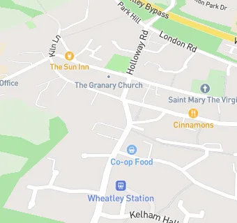
map for Midcounties Cooperative

Near Midcounties Cooperative

  1. Retail Stores
  2. 0.1 miles★★★Wheatley's Local, OX331XP
  3. 0.1 miles★★★★Cricks Butchers, OX331XP
  4. 0.5 miles★★★★★Sweet Yourself Ltd, OX331XW
  5. 1.3 milesWheatley Farm Shop, OX331DW
  6. 1.5 miles★★★★★Horspath Stores, OX331RU
  7. 1.9 miles★★★★★BP Petrol Station at Welcome Break Oxford, OX331LJ
  8. 1.9 milesW H Smith at Welcome Break Oxford, OX331LJ
  9. 2.3 miles★★★★★Risinghurst Post Office, OX38HR
  10. Food Trucks
  11. 0.1 miles★★★★★High Street Grilled Food,
  12. Bars & Nightclubs
  13. ★★★★★The King & Queen, OX331XT
  14. 0.1 miles★★★★★The Sun, OX331NB
  15. Restaurants & Cafés
  16. 0.1 miles★★★Cinnamons, OX331XP
  17. 0.1 miles★★★Cornfield Bakery, OX331XP
  18. Takeaway Shops
  19. ★★★★Marios Fish & Chips, OX331ST
  20. 0.1 miles★★★★Jones Garden, OX331XP
  21. Chemists
  22. 0.1 milesWheatley Pharmacy, OX331DP
  23. Schools
  24. 0.3 milesJohn Watson School, OX331NN (112 pupils)
  25. Schools Nursery
  26. 0.3 milesWheatley Nursery School, OX331NN (48 pupils)
  27. Schools Primary
  28. 0.3 milesWheatley Church of England Primary School, OX331NN (291 pupils)
  29. 1.5 milesHorspath Church of England Primary School, OX331RY (137 pupils)
  30. Schools Secondary
  31. 0.5 milesWheatley Park School, OX331QH (1135 pupils)

See all Retail Stores in Wheatley.