BLOCLEats

Newcastle (Metrocentre) Premier Inn

Derwenthaugh Road
Blaydon
Blaydon On Tyne
NE163BL

Food rating: ★★★★★ 5/5 stars
Updated: 23. March 2023

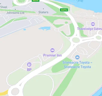
map for Newcastle (Metrocentre) Premier Inn

Near Newcastle (Metrocentre) …

  1. Bars & Nightclubs
  2. 0.5 miles★★★★★O'wa The Road Limited, NE163DS
  3. 1.0 mile★★★★★Fairholme Social Club, NE157PL
  4. 1.0 mile★★★★Bisley Hotel, NE215AF
  5. 1.0 mile★★★★★Swalwell Cricket Club, NE216JA
  6. 1.0 mile★★★★★Swalwell Junior Football Club, NE216JA
  7. 1.1 miles★★★★★Scotswood Social Club, NE157HB
  8. 1.3 miles★★★Anne's Kitchen At The Vallum, NE157RG
  9. 1.3 miles★★★★★Blaydon Cricket Club, NE215DE
  10. Hotels & BnBs
  11. 0.2 miles★★★★★Travelodge Gateshead, NE163BE
  12. Food Trucks
  13. 0.2 miles★★★★★Steak House, NE215LL
  14. Restaurants & Cafés
  15. 0.2 miles★★★★★Sambuca Metro Ltd, NE163BE
  16. Retail Stores
  17. 0.1 miles★★★★★BP, NE163BJ
  18. 0.4 miles★★★★★SMK Retailer Limited, NE215PG
  19. Chemists
  20. 0.2 milesPch Chemist, NE163BQ
  21. Doctors
  22. 0.4 milesBlaydon Gp Led Practice, NE215NW
  23. 0.4 milesBlaydon Primary Care Centre, NE215NW
  24. Schools All Through
  25. 0.9 milesExcelsior Academy, NE156AF (1460 pupils)
  26. Schools Primary
  27. 0.8 milesSwalwell Primary School, NE163HZ (151 pupils)
  28. 0.9 milesBridgewater Primary School, NE156NL (472 pupils)
  29. 1.0 mileFront Street Community Primary School, NE164AY (410 pupils)
  30. 1.0 mileSt Joseph's Catholic Primary School, Benwell, NE156JB (227 pupils)

See all Bars & Nightclubs in Blaydon-on-Tyne.