BLOCLEats

Northampton & Lamport Railway

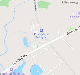
Pitsford And Brampton Station
Pitsford Road
Chapel Brampton
West Northamptonshire
NN68BA

Food rating: ★★★★★ 5/5 stars
Updated: 31. October 2019

Food ratings

Hygiene: 5
Structural: 5

map for Northampton & Lamport Railway

Near Northampton & …

  1. Restaurants & Cafés
  2. 0.7 miles★★★★★Brampton Grange, NN68AD
  3. 1.1 miles★★★★★ABM at Buckton Fields Primary, NN28ES
  4. 1.2 miles★★★★★Cafemonde, NN68BH
  5. 1.2 miles★★★★★The Stables Day Centre, NN28PT
  6. 1.4 miles★★★★Lasaan (Once Upon A Time In India), NN28EP
  7. 1.4 milesBrindia, NN28UE
  8. 1.4 miles★★★★★The Obelisk Centre, NN28UE
  9. 1.4 miles★★★★★Ts And Coffee,
  10. Care Facilities
  11. 0.8 miles★★★★★Brampton View Ltd, NN68GH
  12. Hotels & BnBs
  13. 0.2 miles★★★★★Compass at Sedgebrook Hall, NN68BD
  14. Food Trucks
  15. 0.7 miles★★★★★KO Catering, NN68BE
  16. Bars & Nightclubs
  17. 0.3 miles★★★★★Brampton Halt, NN68BA
  18. 0.4 miles★★★★★Spencer Arms, NN68AE
  19. 0.9 miles★★★★★Brampton Heath Golf Centre, NN68AX
  20. Retail Stores
  21. 1.0 mile★★★★★Sauls Of Spratton, NN68AA
  22. School Food Ratings
  23. 0.5 miles★★★★★Kingswood at The Bramptons Primary, NN68AW
  24. Schools Nursery
  25. 1.4 milesWhitehills Nursery School, NN28DF (45 pupils)
  26. Schools Primary
  27. 0.5 milesThe Bramptons Primary School, NN68AW (99 pupils)
  28. 1.1 milesBuckton Fields Primary School, NN28ES (168 pupils)
  29. 1.4 milesBoughton Primary School, NN28RG (197 pupils)
  30. 1.4 milesWhitehills Primary School, NN28DF (417 pupils)

See all Restaurants & Cafés in Northampton.