BLOCLEats

Papa Johns

73 Lichfield Road
Wolverhampton
West Midlands
WV111TW

Food rating: ★★★★★ 5/5 stars
Updated: 25. July 2024

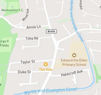
map for Papa Johns

Near Papa Johns

  1. Takeaway Shops
  2. ★★★★★Jasmine House Chinese Takeaway, WV111TW
  3. 0.1 miles ★★★D&G Fish Bar, WV111TF
  4. 0.2 miles ★★★★Aykam Sweet Centre, WV111ST
  5. 0.2 miles ★★★★★King Fryer, WV111SS
  6. 0.3 miles ★★★Pizzaland Wolves, WV111SR
  7. 0.3 miles ★★★★★CN's Chippy, WV111UN
  8. 0.4 miles ★★★★★The Golden Chopstick, WV111UN
  9. 0.4 miles ★★★Chill N Grill, WV113DD
  10. Catering Services
  11. ★★★Spice River, WV111TW
  12. Seventh Day Adventist Church, WV111TP
  13. Bars & Nightclubs
  14. ★★★★★The Vine Inn, WV111TN
  15. Restaurants & Cafés
  16. ★★★★★Masala Lounge, WV111TW
  17. ★★★★★Penguin Cafe, WV111TW
  18. Retail Stores
  19. ★★★★★Moore & Sons (Off Licence) Ltd, WV111TW
  20. 0.1 miles ★★★★Premier Wednesfield Convenience Store, WV111TF
  21. Dentists
  22. Wednesfield Dental Practice, WV111TP
  23. Schools
  24. 0.2 miles Jennie Lee Centre, WV113HT
  25. Schools Primary
  26. 0.3 miles St Patrick's Catholic Primary Academy, WV111PG (242 pupils)
  27. 0.3 miles St Thomas' Church of England Primary Academy, WV113TG (206 pupils)
  28. 0.4 miles Wodensfield Primary School, WV111PW (476 pupils)
  29. Schools Secondary
  30. 0.3 miles Wednesfield Academy, WV113ES (1066 pupils)