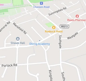
BLOCLEats

Peter Pan

173 Church Road
Urmston
Manchester
M416EA

Food rating: ★★★★ 4/5 stars
Updated: 16. October 2023

map for Peter Pan

Near Peter Pan

  1. Takeaway Shops
  2. 0.7 miles★★★★Charlie's Fish and Chip Shop, M410TP
  3. 1.3 miles★★★★★Chic Box & K Town, M335PN
  4. 1.4 miles★★★★★Riverbank Coffee, M419WL
  5. 1.8 miles★★★★★Millies Cookies, M178BL
  6. 1.8 miles★★★★★Barburrito, M178EH
  7. 1.9 miles★★★★★Just Bee Honey,
  8. 2.0 miles★★★★★Subway, M446EH
  9. 2.0 milesPanku Streetfood, M417ZA
  10. Care Facilities
  11. 0.4 miles★★★★★Urmston Manor, M419EJ
  12. Catering Services
  13. 0.2 milesSchool of Play MCR, M415AH
  14. Bars & Nightclubs
  15. ★★★★Roebuck Hotel, M416HD
  16. 0.3 miles★★★★★Flixton Golf Club & Course, M416EP
  17. 0.4 miles★★★★★Flixton Conservative Club, M415DF
  18. Retail Stores
  19. ★★★★★Barrows Bakery, M416EA
  20. 0.2 milesReeds Chemist, M419FD
  21. Chemists
  22. 0.2 milesReeds Pharmacy, M419FD
  23. Schools
  24. 0.4 milesAbbotsford Preparatory School, M415PR (183 pupils)
  25. Schools Primary
  26. 0.6 milesUrmston Primary School, M415AH (507 pupils)
  27. 0.6 milesSt Michael's CofE (Aided) Primary School, M416JB (244 pupils)
  28. 0.6 milesEnglish Martyrs' RC Primary School, M415AH (225 pupils)
  29. Schools Secondary
  30. 0.5 milesFlixton Girls School, M415DR (947 pupils)

See all Takeaway Shops in Urmston.