BLOCLEats

Poundland

Unit 2 Springfield Retail Park
Hucknall Lane
Nottingham
NG68AJ

Food rating: ★★★★★ 5/5 stars
Updated: 22. June 2021

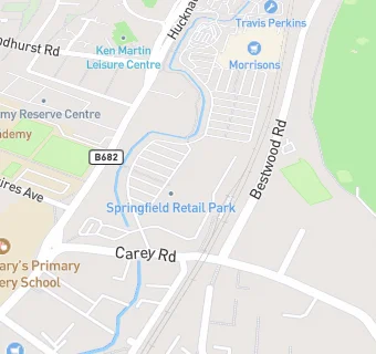
map for Poundland

Near Poundland

  1. Retail Stores
  2. Wickes Building Supplies Ltd,
  3. 0.2 miles★★★★★Morrisons Daily Bulwell Petrol Station, NG68EP
  4. 0.2 miles★★★★★Tesco Bulwell Petrol Station, NG68EQ
  5. 0.2 miles★★★★★Groszek Supermarket, NG68ED
  6. 0.3 miles★★★★★Mount Zion 7th Day Church of God Food Bank, NG68ET
  7. 0.4 miles★★★★Budget Wise, NG68HA
  8. 0.4 milesArgos, NG68FB
  9. 0.5 miles★★★★★Darrell Lowe Fruit & Veg Stall,
  10. Bars & Nightclubs
  11. 0.1 miles★★★★★Bestwood Road Sports And Social Club, NG68UA
  12. 0.1 miles★★★★★The Newstead Abbey, NG69JS
  13. Restaurants & Cafés
  14. ★★★★★McDonalds Restaurants, NG68AJ
  15. Takeaway Shops
  16. ★★★★★KFC Bulwell Drive Thru, NG68AJ
  17. Chemists
  18. 0.1 milesSt Albans Pharmacy, NG68AQ
  19. 0.2 milesTesco Instore Pharmacy, NG68EQ
  20. Dentists
  21. 0.2 milesBulwell Dental Practice, NG69JQ
  22. Doctors
  23. 0.1 milesSt Albans Medical Centre, NG68AQ
  24. Schools Primary
  25. 0.2 milesBulwell St Mary's Primary and Nursery School, NG68GQ (236 pupils)
  26. 0.3 milesCantrell Primary and Nursery School, NG69HJ (443 pupils)
  27. 0.3 milesCantrell Primary and Nursery School, NG69HJ
  28. 0.4 milesStanstead Flying High Academy, NG55BL (207 pupils)
  29. Schools Secondary
  30. 0.2 milesThe Bulwell Academy, NG68AQ (1070 pupils)

See all Retail Stores in Nottingham.