BLOCLEats

Railway Hotel

Station Road
Lytham St. Annes
FY85DH

Food rating: ★★★★★ 5/5 stars
Updated: 13. May 2024

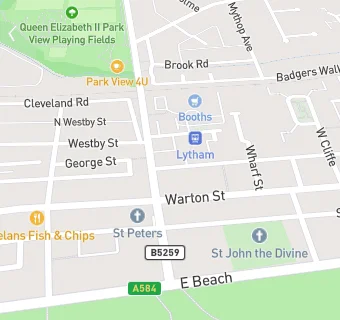
map for Railway Hotel

Near Railway Hotel

  1. Bars & Nightclubs
  2. 0.1 miles★★★★★Lytham Catholic Club, FY85HR
  3. 0.3 miles★★★★★Ribble Cruising Club, FY85LD
  4. 0.3 miles★★★★★Lytham ex-service and social club, FY85ND
  5. 0.3 miles★★★★★The Taps, FY85LE
  6. 0.4 miles★★★★★County Hotel, FY85LH
  7. 0.4 miles★★★★★Station Pub and Grill, FY85PA
  8. 0.6 miles★★★★★Lowther Pavilion, FY85QQ
  9. 0.6 miles★★★★★Lytham Green Drive Golf Club, FY84LE
  10. Care Facilities
  11. 0.1 miles★★★★★Cross and Passion Convent, FY85EU
  12. 0.1 miles★★★★★ABM Catering @ Adlington The Sidings, FY85DP
  13. Catering Services
  14. 0.1 miles★★★★★Lytham St Annes Sea Cadets, FY85EG
  15. Retail Stores
  16. ★★★★★Divino Lytham, FY85ER
  17. Takeaway Shops
  18. 0.2 miles★★★Elvin's Streetfood Ltd, FY85ER
  19. Chemists
  20. 0.2 milesBoots, FY85EW
  21. 0.2 milesSmiths Pharmacy, FY85HA
  22. Dentists
  23. 0.1 milesM J Kenyon Dental Practice, FY85EP
  24. Schools Primary
  25. 0.4 milesLytham Church of England Voluntary Aided Primary School, FY84HA (201 pupils)
  26. 0.5 milesSt Peter's Catholic Primary School, Lytham, FY84JG (206 pupils)
  27. 0.7 milesLytham Hall Park Primary School, FY84QU (401 pupils)
  28. 1.7 milesAnsdell Primary School, FY84DR (239 pupils)
  29. Schools Secondary
  30. 0.4 milesSt Bede's Catholic High School, Lytham, FY84JL (824 pupils)

See all Bars & Nightclubs in Lytham St Annes.