BLOCLEats

Silverstone Recreation Assoc.

Silverstone Recreation Centre
Church Street
Silverstone
NN128XA

Food rating: ★★★★★ 5/5 stars
Updated: 25. January 2022

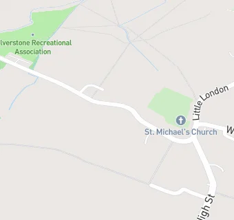
map for Silverstone Recreation Assoc.

Near Silverstone Recreation …

  1. Bars & Nightclubs
  2. 0.1 milesThe White Horse., NN128UW
  3. 1.6 miles★★★★The Fox and Hounds, NN128XJ
  4. 1.8 miles★★★★★New Inn Abthorpe, NN128QR
  5. 1.9 miles★★★★★The Green Man, NN135TX
  6. 2.5 miles★★★★★Silverstone Golf Club, MK185LH
  7. 2.6 milesWappenham pub night, NN128SG
  8. 2.8 milesThe Kings Head, NN135HW
  9. 2.8 miles★★★★★Towcester Sports & Social Club, NN126HD
  10. Manufacturers
  11. 0.1 milesSilverstone Brewery, NN128US
  12. Food Trucks
  13. 0.3 miles★★★★★Kings Campsite, NN128UP
  14. Restaurants & Cafés
  15. 0.1 miles★★★★St Michael's Church Rooms, NN128UW
  16. 0.3 miles★★★★★Silverstone Community Cafe, NN128US
  17. 0.3 miles★★★★★Silverstone Farm Campsite, NN128UP
  18. Retail Stores
  19. 0.1 miles★★★★Matthew Croft Stores, NN128UW
  20. School Food Ratings
  21. 0.3 miles★★★★★ABM Catering Limited, NN128UB
  22. Doctors
  23. 0.2 milesSilson Surgery, NN128UN
  24. Schools
  25. 0.8 milesOn Track Education Silverstone, NN128UB (30 pupils)
  26. Schools Primary
  27. 0.4 milesSilverstone Church of England Primary School, NN128UB (246 pupils)
  28. 1.6 milesWhittlebury Church of England Primary School, NN128XH (52 pupils)
  29. 2.7 milesNicholas Hawksmoor Primary School, NN126JA (425 pupils)
  30. Schools Secondary
  31. 1.2 milesSilverstone UTC, NN128TL (442 pupils)

See all Bars & Nightclubs in Silverstone.