BLOCLEats

Society

8 Stephenson Place
Chesterfield
S401XL

Food rating: ★★★★★ 5/5 stars
Updated: 16. October 2021

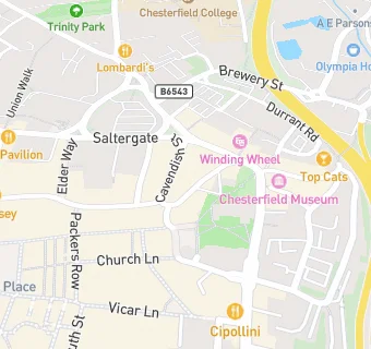
map for Society

Near Society

  1. Restaurants & Cafés
  2. ★★★Victoria Cafe, S401XL
  3. ★★Bagel Loft,
  4. 0.1 miles ★★★★★Subway (Low Pavements), S401PQ
  5. 0.1 miles ★★★★★Fuelled by Savvy Baker, S417TH
  6. 0.1 miles ★★★★★Indian Blues, S417TU
  7. 0.1 miles ★★★★★Cobbles Cafe, S401PT
  8. 0.1 miles ★★★★★The Old Post Restaurant, S417SH
  9. 0.1 miles ★★★★★Cornerstone Coffee Shop, S401UH
  10. Bars & Nightclubs
  11. ★★★★★Victoria, S401RL
  12. ★★★★★Fist and Puppet Ltd, S401XL
  13. ★★★★★Ginners, S401XL
  14. ★★★★★Groove and Waikki Beach, S401XR
  15. The Bank, S401XP
  16. Retail Stores
  17. ★★★★★Debbies Food Ltd, S401XA
  18. Takeaway Shops
  19. ★★★Sheraz, S401XA
  20. ★★★★★Tuminose, S401UY
  21. Schools
  22. 0.7 miles St Peter and St Paul School, S410EF (111 pupils)
  23. Schools 16 Plus
  24. 0.3 miles Chesterfield College, S417NG
  25. Schools Primary
  26. 0.5 miles St Mary's Catholic Primary, S404ST (418 pupils)
  27. 0.5 miles Abercrombie Primary School, S417QE (255 pupils)
  28. Schools Secondary
  29. 0.7 miles Parkside Community School, S402NS (601 pupils)