BLOCLEats

SPAR

119 Marsden Road
South Shields
Tyne & Wear
NE346RH

Food rating: ★★★★★ 5/5 stars
Updated: 2. July 2019

Food ratings

  • Confidence in management: 5
  • Hygiene: 5
  • Structural: 5
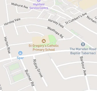
map for SPAR

Near SPAR

  1. Retail Stores
  2. 0.2 miles ★★★★Horsley Hill Mini Market, NE347HE
  3. 0.2 miles ★★★★★Your Community Shop by Hospitality and Hope, NE347HE
  4. 0.3 miles ★★★★★M.I.Dickson Ltd, NE347HQ
  5. 0.4 miles ★★★★One Stop Harton Convenience Store, NE346AD
  6. 0.4 miles ★★★★★One Stop, NE346HF
  7. 0.6 miles Boots UK Ltd, NE347LZ
  8. 0.6 miles Card Factory, NE347LZ
  9. 0.6 miles Superdrug Stores plc, NE347LZ
  10. Care Facilities
  11. 0.2 miles ★★★★★Cheviot Court, NE346RF
  12. Food Trucks
  13. 0.2 miles Smilers News, NE346RF
  14. Restaurants & Cafés
  15. 0.2 miles ★★★★★Combined Touch CIC, NE347HE
  16. School Food Ratings
  17. 0.1 miles ★★★★★St Gregory's Catholic Primary School, NE346DZ
  18. Takeaway Shops
  19. ★★★★Red Star Chop Suey House, NE346RH
  20. Dentists
  21. 0.2 miles Marsden Road Dental Practice, NE346RE
  22. Doctors
  23. 0.2 miles Marsden Medical Group, NE346RE
  24. 0.2 miles Marsden Road Health Centre, NE346RE
  25. Schools
  26. 0.3 miles Bamburgh School, NE347TD (216 pupils)
  27. Schools Primary
  28. St Gregory's Catholic Primary School, South Shields, NE346DZ (201 pupils)
  29. 0.3 miles Sea View Primary School, NE347TD (421 pupils)
  30. 0.4 miles Harton Primary School, NE346PF (684 pupils)
  31. Schools Secondary
  32. 0.4 miles Harton Academy, NE346DL (1659 pupils)