BLOCLEats

St Michael's Café

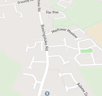
St Michael And All Angels' Church
Basingstoke Road
Spencers Wood
RG71AP

Food rating: ★★★★★ 5/5 stars
Updated: 4. January 2023

map for St Michael's Café

Near St Michael's …

  1. Restaurants & Cafés
  2. 0.2 miles★★★★★SWVH Kitchen, RG71DY
  3. 0.3 miles★★★★★Miah's Restaurant, RG71AE
  4. 1.0 mile★★★★★Gateway Coffee Morning, RG29BY
  5. 1.2 miles★★★★★Crumbs, RG29EH
  6. 1.3 miles★★★★★Subway at Shinfield Service Station, RG29DY
  7. 1.5 miles★★★★★Mad House Play & Party World, RG26UL
  8. 1.5 miles★★★★★WOLF Italian Street Food, RG26UG
  9. 1.7 miles★★★★★Cafe No. 1, RG29LH
  10. Logistics Providers
  11. 0.4 milesColucci's Wines Ltd, RG71AT
  12. Bars & Nightclubs
  13. 0.3 miles★★★★★The Farriers Arms, RG71AE
  14. 0.4 miles★★★★★The Swan, RG71AT
  15. Retail Stores
  16. 0.4 miles★★★★★Budgens, RG71BA
  17. 0.4 miles★★★★★Three Mile Cross Post Office & Stores, RG71AT
  18. 0.6 miles★★★★★Greggs @ MFG Swallowfield, RG71LZ
  19. 0.6 miles★★★★★MFG Swallowfield, RG71LZ
  20. 0.6 miles★★★★One Stop, RG71AD
  21. Schools
  22. 0.4 milesThe Vine Christian School, RG71HF (28 pupils)
  23. Schools Primary
  24. 0.8 milesAlder Grove Church of England Primary School, RG29RA (290 pupils)
  25. 1.0 mileLambs Lane Primary School, RG71JB (202 pupils)
  26. 1.0 mileGrazeley Parochial Church of England Aided Primary School, RG71JY (203 pupils)
  27. Schools Secondary
  28. 0.4 milesOakbank, RG71ER (522 pupils)

See all Restaurants & Cafés in Reading.