BLOCLEats

Storrs Road Pre School

Upper Moor Street
Chesterfield
S403NR

Food rating: ★★★★★ 5/5 stars
Updated: 13. September 2024

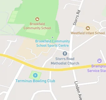
map for Storrs Road Pre School

Near Storrs Road …

  1. Catering Services
  2. 0.1 miles ★★★★★Storrs Road Church Centre, S403PY
  3. 1.0 mile ★★★★★Loundsley Green Methodist Church, S404NF
  4. 1.0 mile ★★★★★The Parochial Council Of St John's Church, S427LT
  5. 1.1 miles ★★★★★Lifehouse Church, S402AN
  6. 1.1 miles ★★★★Brampton Pi Shop, S402AR
  7. 1.1 miles ★★★★★Raras Kitchen@Holmehall Inn, S404UX
  8. 1.2 miles ★★★★★Greggs, S402AQ
  9. 1.3 miles ★★★★★Holymoorside United Reformed Church, S427EG
  10. Retail Stores
  11. 0.1 miles ★★★Henstocks Bakers Shop, S403JX
  12. 0.1 miles ★★★★★Londis (Chatsworth Road), S403JX
  13. 0.1 miles ★★★★★Rontec, S403JX
  14. School Food Ratings
  15. 0.1 miles ★★★★★Brookfield Community School, S403NS
  16. Takeaway Shops
  17. 0.1 miles ★★★★★Hong Hei, S403JX
  18. Chemists
  19. 0.1 miles Peak Pharmacy, S403JX
  20. Doctors
  21. 0.1 miles Chatsworth Road Medical Centre, S403PY
  22. 0.1 miles Chatsworth Road Medical Centre, S403PY
  23. Schools
  24. 0.8 miles Ashgate Croft School, S404BN (154 pupils)
  25. Schools Primary
  26. 0.2 miles Westfield Infant School, S403NW (177 pupils)
  27. 0.6 miles Old Hall Junior School, S403QR (246 pupils)
  28. 0.9 miles Walton Holymoorside Primary School, S427DU (369 pupils)
  29. Schools Secondary
  30. 0.1 miles Brookfield Community School, S403NS (1143 pupils)