BLOCLEats

Subway

835C Hagley Road West
Birmingham
B321AD

Food rating: ★★★★★ 5/5 stars
Updated: 11. November 2023

Food ratings

Confidence in management: 5
Hygiene: 5
Structural: 5
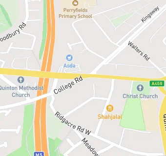
map for Subway

Near Subway

  1. Retail Stores
  2. ★★★★★Starbucks, B680PH
  3. 0.1 miles★★★★Glorious Convenience and Booze, B680PJ
  4. 0.4 milesGrange Pharmacy, B620HN
  5. 0.4 miles★★★★★One Stop Stores, B620HN
  6. 0.4 miles★★★Prestige food & wine, B620HN
  7. 0.4 milesSpar, B620HN
  8. 0.6 miles★★★★★Greggs Plc, B680BZ
  9. 0.6 miles★★★★Johal News, B629RH
  10. Restaurants & Cafés
  11. ★★★★★Milano Lounge, B680PJ
  12. 0.1 milesBig John’s Quinton, B680PJ
  13. 0.1 miles★★★★★Quinton Methodist Church, B629AU
  14. 0.1 miles★★★★Reel Quinton, B629AS
  15. Supermarkets
  16. ★★★★★Asda (Quinton), B680PH
  17. School Food Ratings
  18. 0.1 miles★★★★★Quinton Church Primary Sch Academy, B321AJ
  19. Takeaway Shops
  20. 0.1 miles★★★★Marvil Take-Away Shop, B680PJ
  21. 0.1 miles★★★★Rose's Sandwich Bar, B680PJ
  22. Schools Primary
  23. 0.1 milesQuinton Church Primary School, B321AJ (212 pupils)
  24. 0.2 milesPerryfields Primary School, B680QY (348 pupils)
  25. 0.4 milesHowley Grange Primary School, B620HS (414 pupils)
  26. 0.6 milesFour Dwellings Primary Academy, B321PJ (345 pupils)
  27. Schools Secondary
  28. 0.4 milesPerryfields Academy, B680RG (942 pupils)

See all Retail Stores in Birmingham.