BLOCLEats

Subway

65
Borough High Street
London
SE11NF

Food rating: ★★★★★ 5/5 stars
Updated: 28. June 2023
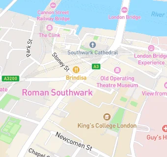
map for Subway

Near Subway

  1. Takeaway Shops
  2. ★★★★★Food and forest, SE11TL
  3. ★★★★★Padre limited, SE19AG
  4. 0.1 miles★★★★★Gujarati rasoi, SE19AH
  5. 0.1 miles★★★★★Richard haward's oysters, SE19AH
  6. 0.1 miles★★★★★Bubbyogu, SE19BZ
  7. 0.1 miles★★★★★Kaleido, SE19SP
  8. 0.1 milesOroshi, SE11TL
  9. 0.1 miles★★★★★The tinned fish market, SE19AL
  10. Care Facilities
  11. ★★★★★Main kitchen thomas guy house, SE19RT
  12. Restaurants & Cafés
  13. ★★★★★Toms's @ guy's cafe, SE19RT
  14. ★★★★★Hca international ltd, SE19RT
  15. ★★★★★Keats (guys hospital), SE19RT
  16. ★★★★★Amt coffee, SE19RT
  17. Retail Stores
  18. ★★★★★Alpine deli, SE11TL
  19. ★★★★★Alsop and walker ltd, SE11TL
  20. Chemists
  21. City Pharmacy, SE11LZ
  22. Schools
  23. 0.3 milesBeormund Primary School, SE13PS (37 pupils)
  24. 0.3 milesLondon Christian School, SE14JU (118 pupils)
  25. Schools Primary
  26. 0.2 milesSaint Joseph's Catholic Primary School, the Borough, SE11NJ (176 pupils)
  27. 0.2 milesThe Cathedral School of St Saviour and St Mary Overie, SE11HG (213 pupils)
  28. 0.3 milesSnowsfields Primary School, SE13TD (197 pupils)

See all Takeaway Shops in London.