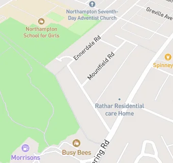
BLOCLEats

The Avenue

2 The Avenue
Spinney Hill
Northampton
NN3 6BA
NN36BA

Food rating: ★★★★★ 5/5 stars
Updated: 27. November 2024

map for The Avenue

Near The Avenue

  1. Care Facilities
  2. 0.1 miles★★★★★Rathgar Residential Care Home, NN36QT
  3. 0.1 miles★★★★★Busy Bees, NN36AA
  4. 0.2 miles★★★★★Alderwood LLA, NN32AB
  5. 0.2 miles★★★★★Alderwood LLA Ltd, NN32AB
  6. 0.3 miles★★★★★Squires Mews, NN36QP
  7. 0.3 miles★★★★★Samuels, NN32QY
  8. 0.4 miles★★★★★Manfield Health Campus, NN36NP
  9. 0.4 miles★★★★★Wallace Road Nursery, NN27EE
  10. Bars & Nightclubs
  11. 0.2 miles★★★★★Spinney Hill Public House, NN36LR
  12. Restaurants & Cafés
  13. 0.1 miles★★★★★Starbucks Coffee, NN36AA
  14. Retail Stores
  15. 0.1 miles★★★★★Morrisons Daily Northampton, NN36AA
  16. Supermarkets
  17. 0.1 miles★★★★★Northampton Kettering Road S/S, NN36AA
  18. Takeaway Shops
  19. 0.1 miles★★★★★McDonalds, NN36AA
  20. Chemists
  21. 0.3 milesPark Avenue Pharmacy, NN32HZ
  22. Doctors
  23. 0.3 milesPark Avenue Medical Centre, NN32HZ
  24. 0.3 milesPark Ave Med Cnt & Kings Heath Practice, NN32HZ
  25. Schools Nursery
  26. 0.4 milesWallace Road Nursery School, NN27EE (46 pupils)
  27. 0.4 milesParklands Nursery School, NN36DW (53 pupils)
  28. Schools Primary
  29. 0.4 milesKingsley Primary School, NN27EE (401 pupils)
  30. 0.4 milesEastfield Academy, NN32RJ (212 pupils)
  31. Schools Secondary
  32. 0.3 milesNorthampton School for Girls, NN36DG (1761 pupils)

See all Care Facilities in Northampton.