BLOCLEats

The Belfry

100 Plumstead High Street
Plumstead
Greenwich
SE181SJ

Food rating: ★★★★★ 5/5 stars
Updated: 17. November 2024

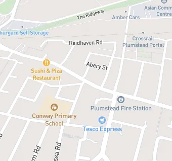
map for The Belfry

Near The Belfry

  1. Bars & Nightclubs
  2. 0.1 miles ★★★★★The Volunteer, SE181JQ
  3. 0.2 miles ★★★★★St Patricks Social Club, SE181AQ
  4. 0.3 miles ★★★★★Plumstead Radical Club, SE187DZ
  5. 0.5 miles ★★★★The Old Mill, SE181QG
  6. 0.5 miles ★★★★★The Rose Inn, SE187TN
  7. 0.6 miles ★★★★The Ship, SE182UJ
  8. 0.6 miles ★★★★★Plumstead Common Working Mens Club, SE182JS
  9. 0.6 miles ★★★★★The Who'd A Thought It Public House, SE182SB
  10. Restaurants & Cafés
  11. ★★★★★Kebabish, SE181SL
  12. ★★★★★Punjabi Dhaba, SE181SB
  13. ★★★★★Red Lion Noodle Bar / Red Lion Sushi Bar, SE181SB
  14. Retail Stores
  15. ★★★High Street News & Wine, SE181SJ
  16. ★★★★★Everest Stores Ltd, SE181SJ
  17. ★★★Plumstead Cash & Carry, SE181SL
  18. Supermarkets
  19. ★★★★★Poundland,
  20. Dentists
  21. Jks Dental Care, SE181SJ
  22. Schools
  23. 0.3 miles The Anchor Sendfriendly Centre, SE181BS (23 pupils)
  24. Schools Primary
  25. 0.1 miles Conway Primary School, SE181QY (449 pupils)
  26. 0.2 miles Bannockburn Primary School, SE181HE (863 pupils)
  27. 0.2 miles St Patrick's Catholic Primary School, SE187QG (342 pupils)
  28. 0.3 miles South Rise Primary School, SE187PX (616 pupils)