BLOCLEats

The Co-Operative Food

Station Road
Pannal
North Yorkshire
HG31JJ

Food rating: ★★★★★ 5/5 stars
Updated: 10. January 2024

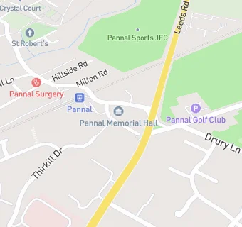
map for The Co-Operative Food

Near The Co-Operative …

  1. Retail Stores
  2. ★★★★★Ubhi's Best Petroleum,
  3. 1.0 mile★★★★★Pannal Ash Stores, HG29LQ
  4. 1.4 miles★★★★★Press Coffee House, HG28QT
  5. 1.4 miles★★★★★Foodpod Solutions Limited (Vending), HG28ER
  6. 1.4 miles★★★★★HG Hampers, HG28QT
  7. 1.8 miles★★★★★Country Butcher (Harrogate) Ltd, HG28AW
  8. 2.0 miles★★★★★Co-op, HG20DP
  9. 2.0 miles★★★★★Harlow Stores, HG20AG
  10. Care Facilities
  11. 0.3 miles★★★★★Crystal Court Care Home, HG31LH
  12. 0.3 miles★★★★★Kids at Heart, HG31LH
  13. 0.4 miles★★★★★Pannal Funclub, HG31LH
  14. Restaurants & Cafés
  15. ★★★★★Crimple Valley Fresh Village Shop, HG31JJ
  16. 0.1 miles★★★★★Costa Coffee, HG31ER
  17. 0.3 miles★★★★★Crimple Food Hall, HG31EW
  18. Dentists
  19. 0.1 milesPannal Dental Clinic, HG31JP
  20. Doctors
  21. 0.1 milesThe Leeds Road Practice, HG31JN
  22. Schools
  23. 1.4 milesAshville College, HG29JP (801 pupils)
  24. Schools Primary
  25. 0.4 milesPannal Primary School, HG31LH (443 pupils)
  26. 1.4 milesOatlands Community Junior School, HG28QP (352 pupils)
  27. 1.5 milesOatlands Infant School, HG28BT (253 pupils)
  28. Schools Secondary
  29. 1.5 milesRossett School, HG29JP (904 pupils)

See all Retail Stores in Pannal.