BLOCLEats

The Crown

56 Long Lane
Aston
Stevenage
Hertfordshire
SG27HD

Food rating: ★★★★ 4/5 stars
Updated: 13. November 2024

Food ratings

Confidence in management: 5
Hygiene: 5
Structural: 10
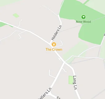
map for The Crown

Near The Crown

  1. Bars & Nightclubs
  2. 0.6 miles★★★★★The Coopers Inn, SG29RZ
  3. 0.6 miles★★★★★The Squirrel, SG20NH
  4. 0.9 miles★★★★★Glebe Sports, SG20DJ
  5. 0.9 miles★★★★The Pig And Whistle, SG27DY
  6. 1.0 mile★★★★★Shephall Tavern, SG29SD
  7. 1.1 miles★★★★★Emperors Head PH, SG27QX
  8. 1.2 miles★★★★★Graveley Cricket Club,
  9. 1.3 miles★★★★★Old Red Lion, SG29XR
  10. Care Facilities
  11. 0.6 miles★★★★★Woodlands View, SG29RZ
  12. Restaurants & Cafés
  13. 0.6 miles★★★★★Poplars Fish Bar, SG29RZ
  14. Retail Stores
  15. 0.6 milesLloyds Chemist, SG27DU
  16. 0.7 miles★★★Chells Way Local Ltd, SG20NB
  17. Supermarkets
  18. 0.6 miles★★★★★Sainsbury's Plc, SG27DU
  19. School Food Ratings
  20. 0.6 miles★★★★★Stevenage Education Support Centre, SG29HQ
  21. Chemists
  22. 0.6 milesPoplars Pharmacy, SG29RZ
  23. Doctors
  24. 0.5 milesThe Poplars Surgery, SG29QQ
  25. Schools
  26. 0.9 milesStevenage Education Support Centre, SG29HQ (2 pupils)
  27. Schools Primary
  28. 0.7 milesAshtree Primary School and Nursery, SG29JQ
  29. 0.7 milesAshtree Primary School and Nursery, SG29JQ (269 pupils)
  30. 0.8 milesAston St Mary's Church of England Aided Primary School, SG27HA (128 pupils)
  31. 0.8 milesFeatherstone Wood Primary School, SG29PP (185 pupils)

See all Bars & Nightclubs in Aston.