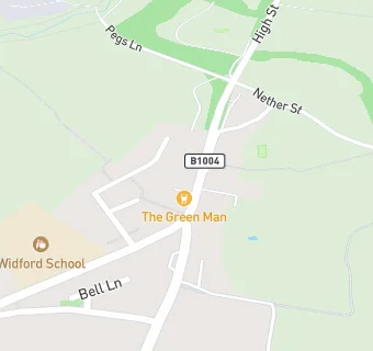
BLOCLEats

The Green Man

High Street
Widford
Ware
Hertfordshire
SG128SR

Food rating: ★★★★ 4/5 stars
Updated: 3. March 2014

map for The Green Man

Near The Green …

  1. Bars & Nightclubs
  2. 1.2 miles★★★★★Fox And Hounds, SG128NH
  3. 1.2 miles★★★★The Crown, SG128NZ
  4. 1.5 miles★★★★★Chequers Inn, SG127QY
  5. 1.6 miles★★★★★The White Horse, SG127QX
  6. 1.7 milesBowls Club,
  7. 2.1 miles★★★Prince Of Wales, SG106JP
  8. 2.3 miles★★★★The Queens Head, CM210LS
  9. 2.8 miles★★★★The Lion, CM202QY
  10. Care Facilities
  11. 0.3 miles★★★★★Ash View Nursing Home, SG128RQ
  12. Manufacturers
  13. 0.8 miles★★★★★British Wheatfields, SG128RP
  14. Restaurants & Cafés
  15. 1.4 milesHenry Moore Studios And Gardens, SG106EE
  16. 1.4 miles★★★★★Rosey Lea At Henry Moore Foundation, SG106EE
  17. 1.5 miles★★★★★Henry Moore Foundation Visitor Cafe, SG106EE
  18. Retail Stores
  19. 1.2 miles★★★★★Hunsdon Post Office, SG128NH
  20. School Food Ratings
  21. 0.9 miles★★★★Hunsdon Ducklings Pre-School, SG128NW
  22. 1.1 miles★★★★★Hunsdon J M I School, SG128NT
  23. Schools
  24. 1.3 milesSt Elizabeth's School, SG106EW (44 pupils)
  25. 1.3 milesSt Elizabeth's Centre, SG106EW
  26. Schools Primary
  27. 0.1 milesWidford School, SG128RE (46 pupils)
  28. 1.1 milesHunsdon Junior Mixed and Infant School, SG128NT (110 pupils)
  29. 1.9 milesSt Andrew's CE Primary School and Nursery, SG106DL (211 pupils)

See all Bars & Nightclubs in Widford.