BLOCLEats

The Hermit Club

The Hermitage
Shenfield Road
Brentwood
Essex
CM158AG

Food rating: ★★★★★ 5/5 stars
Updated: 20. February 2018

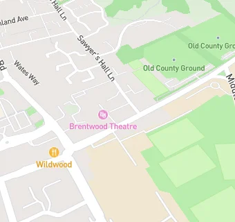
map for The Hermit Club

Near The Hermit …

  1. Bars & Nightclubs
  2. 0.1 miles★★★★★Brentwood County Cricket Club (CHATS), CM158AJ
  3. 0.1 miles★★★★★Brentwood Rugby Club, CM158AT
  4. 0.1 miles★★★★★Brentwood Tennis Club, CM158AJ
  5. 0.1 miles★★★★★Provocative Lounge, CM159AX
  6. 0.1 miles★★★★★Dairyman, CM144AB
  7. 0.1 miles★★★★★Victoria Arms, CM159AX
  8. 0.2 miles★★★Playroom, CM144AJ
  9. 0.2 miles★★★★★Toby Carvery, CM158DZ
  10. Restaurants & Cafés
  11. Sawyers Church, CM159BN
  12. Retail Stores
  13. Burntwood Pharmacy, CM158AG
  14. 0.1 milesThe New Pharmacy, CM144RG
  15. Chemists
  16. Burntwood Pharmacy, CM158AG
  17. Doctors
  18. Tile House Partnership, CM158AQ
  19. Tile House Surgery, CM158AQ
  20. The New Surgery, CM158AB
  21. Dr A Naeem & Partners,The New Surgery, CM158AB
  22. Schools
  23. 0.2 milesBrentwood School, CM158EE (1919 pupils)
  24. Schools Primary
  25. 0.3 milesSt Thomas of Canterbury Church of England Aided Primary School, Brentwood, CM159BX (527 pupils)
  26. Schools Secondary
  27. 0.3 milesBrentwood Ursuline Convent High School, CM144EX (1024 pupils)
  28. 0.4 milesBrentwood County High School, CM144JF (1109 pupils)
  29. 0.4 milesBecket Keys Church of England Free School, CM159DA (1107 pupils)

See all Bars & Nightclubs in Brentwood.