BLOCLEats

The Holly Tree

25 High Street
Addlestone
KT151TN

Food rating: ★★★★★ 5/5 stars
Updated: 19. March 2024

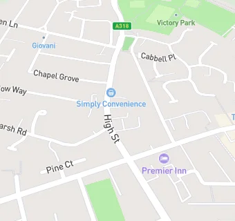
map for The Holly Tree

Near The Holly …

  1. Bars & Nightclubs
  2. 0.9 miles ★★★★★White Hart, KT152DS
  3. 0.9 miles ★★★★★Hare Hill Social Club, KT151AT
  4. 1.1 miles ★★★★★New Haw Club and Institute, KT153NA
  5. 1.2 miles ★★★★★The Queen's Head, KT138XS
  6. 1.3 miles ★★★Weybridge Conservative Club, KT138DL
  7. 1.3 miles ★★★★★Kingfisher, KT168LF
  8. 1.3 miles ★★★★★Chertsey Bowling Club, KT169BW
  9. 1.4 miles ★★★★★Chertsey Social Club, KT169HN
  10. Care Facilities
  11. ★★★★★Eileen Tozer Social Centre, KT152AN
  12. Hotels & BnBs
  13. 0.1 miles ★★★★★Premier Inn Hotels Limited, KT152GL
  14. Restaurants & Cafés
  15. 0.1 miles ★★★★★Nando's Chickenland Ltd, KT152GN
  16. Supermarkets
  17. 0.1 miles ★★★★★Waitrose Ltd, KT152GL
  18. Takeaway Shops
  19. 0.1 miles ★★★★★Mooboo Bubble Tea, KT152GN
  20. Dentists
  21. 0.1 miles Mr S Yourdshahyan, KT152GL
  22. Doctors
  23. 0.1 miles The Crouch Oak Family Practice, KT152BH
  24. 0.1 miles Crouch Oak Family Practice, KT152BH
  25. Schools Primary
  26. 0.2 miles Darley Dene Primary School, KT152NP (231 pupils)
  27. 0.3 miles Sayes Court School, KT151NB (244 pupils)
  28. 0.4 miles St Paul's CofE Primary School, KT151TD (415 pupils)
  29. 0.7 miles Ongar Place Primary School, KT151NY (210 pupils)
  30. Schools Secondary
  31. 0.5 miles Jubilee High School, KT151TE (672 pupils)