BLOCLEats

The Lamb Inn

Chichester Road
West Wittering
Chichester
West Sussex
PO208QA

Food rating: ★★★★★ 5/5 stars
Updated: 4. October 2023

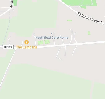
map for The Lamb Inn

Near The Lamb …

  1. Bars & Nightclubs
  2. 1.3 miles★★★★★Silver Horseshoe Club, PO208JG
  3. 1.4 miles★★★★★The Ship Inn, PO207AH
  4. 1.4 miles★★★★★The Shore Inn, PO208DZ
  5. 1.4 miles★★★★★Wittering And District Bowls Club,
  6. 1.4 miles★★★★★Sports Bar, PO208EA
  7. 1.4 miles★★★★★Itchenor Sailing Club, PO207AG
  8. 1.5 miles★★★★★Behind The Stove, PO208PA
  9. 1.5 miles★★★★★Royal British Legion Club, PO208PA
  10. Care Facilities
  11. ★★★★★Heathfield Care Home, PO208QA
  12. 0.8 miles★★★★★BUPA, PO208PT
  13. Hotels & BnBs
  14. 0.3 miles★★★★★Willow House Bed And Breakfast, PO208PZ
  15. Restaurants & Cafés
  16. 0.5 miles★★★★★Amelias Coffee Bar, PO207BY
  17. 0.5 miles★★★★★Earthwise Cafe, PO207BY
  18. Retail Stores
  19. 0.6 miles★★★★★Wicks Farm Caravan Park, PO208QE
  20. 0.8 miles★★★★★K And G's Farm Shop, PO207JE
  21. 0.9 miles★★★★★Campsite, PO208PJ
  22. Schools Primary
  23. 1.2 milesBirdham CE Primary School, PO207HB (122 pupils)
  24. 1.3 milesEast Wittering Community Primary School, PO208NH (280 pupils)
  25. 1.8 milesWest Wittering Parochial Church of England School, PO208AJ (100 pupils)
  26. 2.7 milesSidlesham Primary School, PO207NL (128 pupils)
  27. 3.3 milesBosham Primary School, PO188QF (192 pupils)

See all Bars & Nightclubs in Chichester.