BLOCLEats

The Lane Head

4 Main Road
Ryton
Tyne And Wear
NE403NA

Food rating: ★★★★★ 5/5 stars
Updated: 18. May 2023

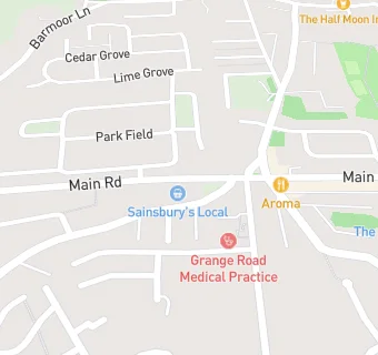
map for The Lane Head

Near The Lane …

  1. Bars & Nightclubs
  2. 0.2 miles★★★★★Ryton Masonic Hall, NE403AE
  3. 0.3 miles★★★Tyneside Golf Club Limited, NE403QE
  4. 1.0 mileKeelman, NE158NL
  5. 1.1 miles★★★★★Ryton Golf Club, NE403TD
  6. 1.1 miles★★★★Ryton Football Club, NE403SN
  7. 1.1 miles★★★★Crawcrook Social Club, NE404NB
  8. 1.2 miles★★★★★Lambs Arms Inn, NE404HJ
  9. 1.3 miles★★★★★Newburn Memorial Club, NE158PR
  10. Care Facilities
  11. 0.3 miles★★★★★Willow Montessori Nursery, NE403QP
  12. Restaurants & Cafés
  13. 0.1 miles★★★★★Miah Restaurant, NE403HF
  14. 0.2 miles★★★★★Miners Lamp Cafe,
  15. Retail Stores
  16. 0.1 miles★★★★★Kathleen's, NE403HF
  17. Chemists
  18. 0.1 milesBoots, NE403HQ
  19. Dentists
  20. 0.1 milesRyton Dental Clinic, NE403HQ
  21. Doctors
  22. Grange Road Medical Practice, NE403LT
  23. Grange Road Medical Practice, NE403LT
  24. Schools Primary
  25. 0.5 milesRyton Community Infant School, NE403AF (119 pupils)
  26. 0.5 milesRyton Junior School, NE403AF (128 pupils)
  27. 0.7 milesCrookhill Community Primary School, NE403ES (181 pupils)
  28. 1.0 mileEmmaville Primary School, NE404ND (482 pupils)
  29. Schools Secondary
  30. 0.4 milesThorp Academy, NE403AH (1460 pupils)

See all Bars & Nightclubs in Ryton.