BLOCLEats

The Lantern Project

Lamphey
Pembroke
Pembrokeshire
SA715NW

Food rating: ★★★★★ 5/5 stars
Updated: 9. January 2019

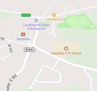
map for The Lantern Project

Near The Lantern …

  1. Restaurants & Cafés
  2. 0.2 miles ★★★★★The Dial Inn, SA715NU
  3. 0.3 miles ★★★★★The Rowan Tree Cafe, SA715PB
  4. 0.5 miles ★★★★★Lamphey Bishops Palace, SA715NT
  5. 1.7 miles ★★★★★Martha's Kitchen, SA724SX
  6. 1.7 miles ★★★★★East Gate Gallery, SA714HN
  7. 1.7 miles ★★★Jacks at The Longhouse, SA715LW
  8. 1.8 miles ★★★★★Alzheimer's Society, SA714DR
  9. 1.8 miles ★★★★Top of the Town Chip Shop, SA714HN
  10. Farmers
  11. 0.5 miles ★★★★★The Ginger Herd, SA715JY
  12. Hotels & BnBs
  13. 0.1 miles ★★★★★Lamphey Hall Hotel, SA715NR
  14. 0.5 miles ★★★★Lamphey Court Hotel, SA715NT
  15. 1.1 miles Tregenna Bed & Breakfast, SA715JL
  16. 1.1 miles ★★★★★The Burrows B & B, SA715LA
  17. Catering Services
  18. 0.3 miles ★★Wellspring Anglican Church, SA715PB
  19. Retail Stores
  20. ★★★★★C K Foodstores, SA715NW
  21. School Food Ratings
  22. ★★★★★Lamphey CP School, SA715NW
  23. Schools
  24. Lamphey C.P. School, SA715NW
  25. 1.7 miles Ysgol Gelli Aur Golden Grove, SA714DP
  26. 2.4 miles Cosheston V.C.P. School, SA724UN
  27. 2.6 miles Ysgol Bro Penfro, SA714RJ
  28. 2.6 miles Monkton Priory CP School, SA714NG